IMAGES TAKEN NEAR TO
Lacewing Close, IPSWICH, IP8 3UD
Introduction
This page details the photographs taken nearby to Lacewing Close, IP8 3UD by members of the Geograph project.
The Geograph project started in 2005 with the aim of publishing, organising and preserving representative images for every square kilometre of Great Britain, Ireland and the Isle of Man.

There are currently over 7.5m images from over14,400 individuals and you can help contribute to the project by visiting https://www.geograph.org.uk
Image Map
Images are licensed for reuse under creativecommons.org/licenses/by-sa/2.0
Notes
- Clicking on the map will re-center to the selected point.
- The higher the marker number, the further away the image location is from the centre of the postcode.
Image Listing (69 Images Found)
Images are licensed for reuse under creativecommons.org/licenses/by-sa/2.0
Image
Details
Distance
1
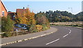
Sweeping curve at the edge of modern housing estate
This is Marbled White Drive.
Image: © Andrew Hill
Taken: 11 Oct 2008
0.00 miles
2
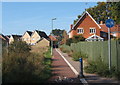
Cycleway and footpath to modern housing estate
Leading to Marbled White Drive.
Image: © Andrew Hill
Taken: 11 Oct 2008
0.04 miles
3
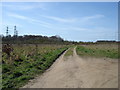
Bridleway to nowhere
This used to lead to Thorington Hall, but it has been brutally severed by the A14.
Image: © Oxymoron
Taken: 5 Apr 2009
0.05 miles
4
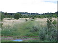
Belsted Brook Park
Part of Belstead Brook Park which is an informal country park
Image: © Roger Jones
Taken: 16 Jul 2011
0.06 miles
5
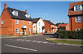
Modern houses
Many of the roads around here are named after butterflies - eg Marbled White, Admiral, Oak Eggar, Skipper, Brimstone.....
Image: © Andrew Hill
Taken: 11 Oct 2008
0.07 miles
6
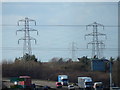
Pylons from Bridge near Thorington Hall
Looking at the sign for junction 55 (A12 South and A1214) half a mile away. The sign is also damaged.
Image: © Hamish Griffin
Taken: 21 Feb 2014
0.09 miles
7
Looking into Ipswich
I think this is Pinewood (which is actually in the Babergh district rather than Ipswich borough), taken from http://www.geograph.org.uk/photo/3858663.
Image: © Hamish Griffin
Taken: 21 Feb 2014
0.09 miles
8
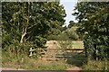
Entrance to Bobbits Lane Local Nature Reserve
The gate gives access to the Local Nature Reserve from Bobbits Lane.
Image: © Simon Mortimer
Taken: 11 Sep 2020
0.09 miles
9

Holly Blue Close
2000s houses in Pinewood.
Image: © Burgess Von Thunen
Taken: 3 Jul 2012
0.11 miles