IMAGES TAKEN NEAR TO
Dashwood Close, IPSWICH, IP8 3SR
Introduction
This page details the photographs taken nearby to Dashwood Close, IP8 3SR by members of the Geograph project.
The Geograph project started in 2005 with the aim of publishing, organising and preserving representative images for every square kilometre of Great Britain, Ireland and the Isle of Man.

There are currently over 7.5m images from over14,400 individuals and you can help contribute to the project by visiting https://www.geograph.org.uk
Image Map
Images are licensed for reuse under creativecommons.org/licenses/by-sa/2.0
Notes
- Clicking on the map will re-center to the selected point.
- The higher the marker number, the further away the image location is from the centre of the postcode.
Image Listing (15 Images Found)
Images are licensed for reuse under creativecommons.org/licenses/by-sa/2.0
Image
Details
Distance
1
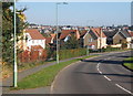
Grove Hill curving into the modern suburbs of southwest Ipswich
This is the lane from Belstead which narrows the other side of the A12/A14 bridge into a typical Suffolk country lane.
Image: © Andrew Hill
Taken: 11 Oct 2008
0.20 miles
3
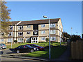
10 - 32 Pin Mill Close
The right-hand end.
Image: © Robin Webster
Taken: 19 Nov 2017
0.22 miles
4
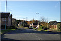
Grove Hill
A road heading out of suburban Ipswich towards Belstead.
Image: © Robin Webster
Taken: 19 Nov 2017
0.22 miles
5
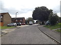
Sycamore Close, Brookwood, Ipswich
At the junction with Belmont Road
Image: © Geographer
Taken: 16 Aug 2014
0.22 miles
6
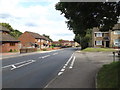
Belmont Road, Brookwood, Ipswich
At the junction with Sycamore Close
Image: © Geographer
Taken: 16 Aug 2014
0.22 miles
7
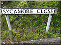
Sycamore Close sign
On Sycamore Close at the junction with Belmont Road
Image: © Geographer
Taken: 16 Aug 2014
0.22 miles
8
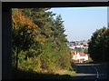
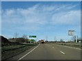
Looking towards Ipswich from underneath the A14
This is Grove Hill heading towards town from Belstead. Southwards, beyond the cutting built to accommodate the lane after the construction of the bridge, the road becomes a typical narrow and twisty Suffolk country lane.
Image: © Andrew Hill
Taken: 11 Oct 2008
0.23 miles
9
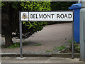
Belmont Road sign
On Belmont Road at the junction with Ellenbrook Road
Image: © Geographer
Taken: 16 Aug 2014
0.24 miles
10
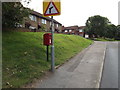
2 Sycamore Close Postbox
Looking towards Yew Tree Rise on Belmont Road
Postbox No.IP8 1427
Image: © Geographer
Taken: 16 Aug 2014
0.25 miles