IMAGES TAKEN NEAR TO
Chattisham Road, IPSWICH, IP8 3HD
Introduction
This page details the photographs taken nearby to Chattisham Road, IP8 3HD by members of the Geograph project.
The Geograph project started in 2005 with the aim of publishing, organising and preserving representative images for every square kilometre of Great Britain, Ireland and the Isle of Man.

There are currently over 7.5m images from over14,400 individuals and you can help contribute to the project by visiting https://www.geograph.org.uk
Image Map
Images are licensed for reuse under creativecommons.org/licenses/by-sa/2.0
Notes
- Clicking on the map will re-center to the selected point.
- The higher the marker number, the further away the image location is from the centre of the postcode.
Image Listing (15 Images Found)
Images are licensed for reuse under creativecommons.org/licenses/by-sa/2.0
Image
Details
Distance
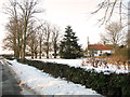
1
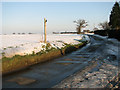
Fingerpost beside the road past Greenfield
Image: © Evelyn Simak
Taken: 11 Feb 2012
0.02 miles
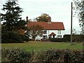
2
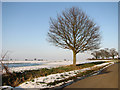
Ancient oak tree beside the lane to Washbrook
Image: © Evelyn Simak
Taken: 11 Feb 2012
0.03 miles
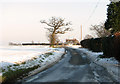
3
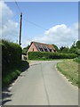
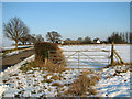
Road Bend
Looking west at a bend in the road between Washbrook and Chattisham, Suffolk.
Image: © Keith Evans
Taken: 21 May 2009
0.04 miles
4
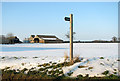
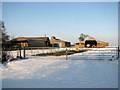
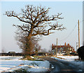
Fingerpost in the snow at Greenfield
Sheds of Coles Green Farm can be seen in the background.
Image: © Evelyn Simak
Taken: 11 Feb 2012
0.06 miles