IMAGES TAKEN NEAR TO
Old School Corner, IPSWICH, IP7 7PB
Introduction
This page details the photographs taken nearby to Old School Corner, IP7 7PB by members of the Geograph project.
The Geograph project started in 2005 with the aim of publishing, organising and preserving representative images for every square kilometre of Great Britain, Ireland and the Isle of Man.

There are currently over 7.5m images from over14,400 individuals and you can help contribute to the project by visiting https://www.geograph.org.uk
Image Map
Images are licensed for reuse under creativecommons.org/licenses/by-sa/2.0
Notes
- Clicking on the map will re-center to the selected point.
- The higher the marker number, the further away the image location is from the centre of the postcode.
Image Listing (28 Images Found)
Images are licensed for reuse under creativecommons.org/licenses/by-sa/2.0
Image
Details
Distance
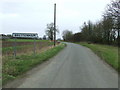
1
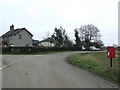
Postbox On Bugg's Lane
Postbox on Bugg's Lane Brettenham, Suffolk.
Image: © Keith Evans
Taken: 6 Mar 2011
0.01 miles
2
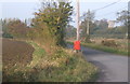
Postbox near lane junction
Brettenham church, right background, in the next square.
Image: © Andrew Hill
Taken: 27 Oct 2007
0.03 miles
4
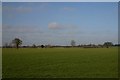
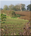
Open farmland at Brettenham
This view is typical of many of the fields in South Suffolk, east of Lavenham.
Image: © Bob Jones
Taken: 1 Feb 2007
0.11 miles
5
Fields near The Well House
Looking over into the next gridsquare.
Image: © Andrew Hill
Taken: 27 Oct 2007
0.17 miles
6
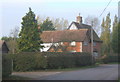
Church Farm, Brettenham
Named on OS 1:25,000 map.
Image: © Andrew Hill
Taken: 27 Oct 2007
0.17 miles
7
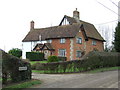
Church Farm
Church Farm at Brettenham, Suffolk.
Image: © Keith Evans
Taken: 6 Mar 2011
0.18 miles
8
Village Name Sign
A newly installed village name sign still has painted location mark on the road for the council workers at Brettenham, Suffolk.
Image: © Keith Evans
Taken: 6 Mar 2011
0.18 miles
9
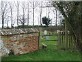
Stile
Stile in the churchyard of St Mary, Brettenham, Suffolk.
Image: © Keith Evans
Taken: 6 Mar 2011
0.21 miles
10

Footpath to Burnthouse Farm
A public footpath heads northwards from Brettenham Church, crossing a playing field belonging to Old Rectory School, where the cricket nets can be seen in the photo. The footpath passes through the gap in the fencing.
Image: © Bob Jones
Taken: 15 Dec 2009
0.21 miles