IMAGES TAKEN NEAR TO
Bildeston Road, IPSWICH, IP7 7JY

Introduction

This page details the photographs taken nearby to Bildeston Road, IP7 7JY by members of the Geograph project.

The Geograph project started in 2005 with the aim of publishing, organising and preserving representative images for every square kilometre of Great Britain, Ireland and the Isle of Man.

There are currently over 7.5m images from over14,400 individuals and you can help contribute to the project by visiting https://www.geograph.org.uk

Image Map


Images are licensed for reuse under creativecommons.org/licenses/by-sa/2.0
Notes
  • Clicking on the map will re-center to the selected point.
  • The higher the marker number, the further away the image location is from the centre of the postcode.

Image Listing (15 Images Found)

Images are licensed for reuse under creativecommons.org/licenses/by-sa/2.0
Image
Details
Distance
1
Please Drive Carefull
Someone has not been driving carefully as this sign has been hit and bent removing the letter y as you enter Wattisham, Suffolk.
Image: © Keith Evans Taken: 6 Sep 2009
0.14 miles
2
Speed restriction sign on entering Wattisham
Image: © Adrian S Pye Taken: 4 Jun 2015
0.14 miles
3
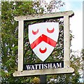
Wattisham village sign
The shield shows the arms of Giles of Wachesham used on his seal of 1325. The Wachesham family had since the early 13th century been in Wattisham and over time held extensive lands in both Norfolk, Suffolk, Essex, and Huntingdonshire. https://www.geograph.org.uk/photo/6785807 
Image: © Adrian S Pye Taken: 26 Aug 2007
0.14 miles
4
Wattisham village sign
The shield shows the arms of Giles of Wachesham used on his seal of 1325. The Wachesham family had, since the early 13th century been in Wattisham and over time held extensive lands in both Norfolk, Suffolk, Essex, and Huntingdonshire. https://www.geograph.org.uk/photo/4295622
Image: © Adrian S Pye Taken: 26 Aug 2007
0.14 miles
5
The Centre Of Wattisham
The village centre of Wattisham, Suffolk.
Image: © Keith Evans Taken: 6 Sep 2009
0.16 miles
6
Wattisham: Blocked access to a cereal crop field
Image: © Michael Garlick Taken: 26 Jun 2020
0.16 miles
7
Lane junction near Wattisham
At the end of Ware Road looking along Hitcham Road which leads to the main part of the village.
Image: © Andrew Hill Taken: 5 Aug 2009
0.16 miles
8
Wattisham Village Sign
The village sign of Wattisham, Suffolk for overall view see http://www.geograph.org.uk/photo/1480729
Image: © Keith Evans Taken: 6 Sep 2009
0.17 miles
9
RAF Wattisham
View across the airfield from the top of a bunker on the Northern HAS site.
Image: © martin more Taken: Unknown
0.17 miles
10
Wattisham Road Junction
Image: © Michael Garlick Taken: 26 Jun 2020
0.17 miles