
IMAGES TAKEN NEAR TO
Wattisham Road, IPSWICH, IP7 7EQ
Introduction
This page details the photographs taken nearby to Wattisham Road, IP7 7EQ by members of the Geograph project.
The Geograph project started in 2005 with the aim of publishing, organising and preserving representative images for every square kilometre of Great Britain, Ireland and the Isle of Man.

There are currently over 7.5m images from over14,400 individuals and you can help contribute to the project by visiting https://www.geograph.org.uk
Image Map
Images are licensed for reuse under creativecommons.org/licenses/by-sa/2.0
Notes
- Clicking on the map will re-center to the selected point.
- The higher the marker number, the further away the image location is from the centre of the postcode.
Image Listing (6 Images Found)
Images are licensed for reuse under creativecommons.org/licenses/by-sa/2.0
Image
Details
Distance
1
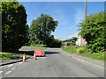
Road closed necessitating a five mile detour
Image: © Adrian S Pye
Taken: 4 Jun 2015
0.09 miles
2
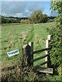
The Sign Spells it out
A clearly worded sign at Bildeston Suffolk.
Image: © Keith Evans
Taken: 1 Oct 2006
0.18 miles
3

Bildeston
Once famous for its blue cloth. The Norfolk Coast website http://www.norfolkcoast.co.uk/location_suffolk/vp_bildeston.htm tells us:
"Bildeston was once a wealthy wool town back in the 15th century famous for its blue cloth and making blankets and this past wealth is reflected in many of the town's buildings."
Image: © Joan Vaughan
Taken: 25 Apr 2006
0.18 miles
4
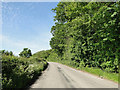
Wattisham Road, a Roman Road with quite a bend in it
Who says all Roman roads are straight!?
Image: © Adrian S Pye
Taken: 4 Jun 2015
0.19 miles
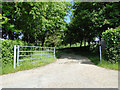
6

Track leading to Bentons
This track leads north-westwards from the minor road between Bildeston and Wattisham, to the farmhouse known as Bentons.
Image: © Bob Jones
Taken: 26 Jan 2010
0.24 miles