
IMAGES TAKEN NEAR TO
Great Bricett, IPSWICH, IP7 7DE
Introduction
This page details the photographs taken nearby to IP7 7DE by members of the Geograph project.
The Geograph project started in 2005 with the aim of publishing, organising and preserving representative images for every square kilometre of Great Britain, Ireland and the Isle of Man.

There are currently over 7.5m images from over14,400 individuals and you can help contribute to the project by visiting https://www.geograph.org.uk
Image Map
Images are licensed for reuse under creativecommons.org/licenses/by-sa/2.0
Notes
- Clicking on the map will re-center to the selected point.
- The higher the marker number, the further away the image location is from the centre of the postcode.
Image Listing (62 Images Found)
Images are licensed for reuse under creativecommons.org/licenses/by-sa/2.0
Image
Details
Distance
3
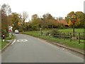
Part of The Street at Great Bricett
The village sign can be seen on the right side of the picture.
Image: © Robert Edwards
Taken: 2 Nov 2010
0.06 miles
4
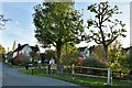
Great Bricett: The Street and Meadow Valley leading from it
Image: © Michael Garlick
Taken: 28 Oct 2022
0.06 miles
5
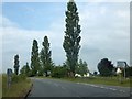
B1078 and junction for Great Bricett
Poplar trees such as these by the road are common in France, but rarely found in the UK
Image: © David Smith
Taken: 19 Jun 2014
0.06 miles
7
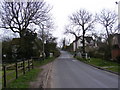
The Street, Great Bricett
Looking towards the junction with the B1078
Image: © Geographer
Taken: 25 Mar 2011
0.08 miles
8
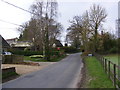
The Street, Great Bricett
Looking towards Wattisham Airfield
Image: © Geographer
Taken: 25 Mar 2011
0.09 miles
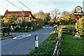
10
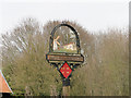
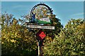
Great Bricett village sign (detail)
The sign has two Blenheim aircraft flying into the sign. These represent RAF Wattisham and were only one of the many types of aircraft which flew from Wattisham during World War Two and after. The parish is very much a part of the domestic site. Below the aircraft is the church of St Mary & St Lawrence. Before Little Bricett’s demise and being swallowed by Offton, St. Lawrence was a Vicarage of Thetford Priory. The smock windmill used to stand behind Mill House in Mill Lane but was demolished in 1954.
Image: © Adrian S Pye
Taken: 8 Apr 2015
0.09 miles