
IMAGES TAKEN NEAR TO
Lindsey, IPSWICH, IP7 6PY
Introduction
This page details the photographs taken nearby to IP7 6PY by members of the Geograph project.
The Geograph project started in 2005 with the aim of publishing, organising and preserving representative images for every square kilometre of Great Britain, Ireland and the Isle of Man.

There are currently over 7.5m images from over14,400 individuals and you can help contribute to the project by visiting https://www.geograph.org.uk
Image Map
Images are licensed for reuse under creativecommons.org/licenses/by-sa/2.0
Notes
- Clicking on the map will re-center to the selected point.
- The higher the marker number, the further away the image location is from the centre of the postcode.
Image Listing (7 Images Found)
Images are licensed for reuse under creativecommons.org/licenses/by-sa/2.0
Image
Details
Distance
1
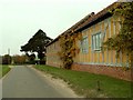
Barn conversion at Folly Farm, Rose Green
Image: © Robert Edwards
Taken: 8 Nov 2006
0.02 miles
3
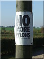
No More Pylons
Campaign poster against the proposed installation of electrical pylons in the area near to Lindsey, Suffolk.
Image: © Keith Evans
Taken: 29 Sep 2011
0.03 miles
5
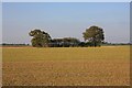
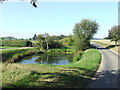
Farmland near Rose Green
A small clump of trees breaks the monotony of the wide fields shorn of their hedgerows.
Image: © Bob Jones
Taken: 23 Oct 2007
0.11 miles
6
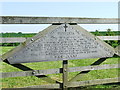
In Loving Memory
Wood in the making the sign tells it all for overall view see http://www.geograph.org.uk/photo/419784
Image: © Keith Evans
Taken: 1 May 2007
0.19 miles
7
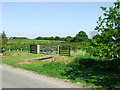
Wood In The Making
One day this will be a wooded area for info as to the creation of this wood see http://www.geograph.org.uk/photo/419787
Image: © Keith Evans
Taken: 1 May 2007
0.19 miles