
IMAGES TAKEN NEAR TO
Lindsey, IPSWICH, IP7 6PT
Introduction
This page details the photographs taken nearby to IP7 6PT by members of the Geograph project.
The Geograph project started in 2005 with the aim of publishing, organising and preserving representative images for every square kilometre of Great Britain, Ireland and the Isle of Man.

There are currently over 7.5m images from over14,400 individuals and you can help contribute to the project by visiting https://www.geograph.org.uk
Image Map
Images are licensed for reuse under creativecommons.org/licenses/by-sa/2.0
Notes
- Clicking on the map will re-center to the selected point.
- The higher the marker number, the further away the image location is from the centre of the postcode.
Image Listing (20 Images Found)
Images are licensed for reuse under creativecommons.org/licenses/by-sa/2.0
Image
Details
Distance
1
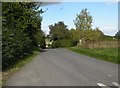
The Road to Lindsey Tye from Lindsey
Image: © Robert Edwards
Taken: 16 Oct 2010
0.04 miles
2
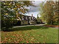
Thatched cottage, close to Lindsey church
Image: © Robert Edwards
Taken: 16 Oct 2010
0.08 miles
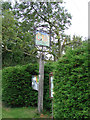
4
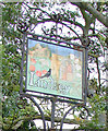
Lindsey village sign (detail)
The sign depicts the church and the crossed keys of St Peter the patron. The monk from the Kersey and Lindsey Priory is collecting tithes on the sheaves of wheat. The sheep are symbolic of the wool trade that once thrived in the parish and gave its name to a type of woollen cloth. The red and white roses refer to the names of the two village pubs. The White Rose is now a private residence. Oh yes and a blackbird?
Image: © Adrian S Pye
Taken: 13 Sep 2008
0.11 miles
5
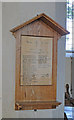
The Roll of Honour at Lindsey
Of the 29 men only two failed to return.
Image: © Adrian S Pye
Taken: 25 Aug 2015
0.11 miles
6
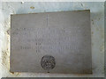
Two names on the War Memorial at Lindsey
Of the 29 men who went to war only these two failed to return.
See the Roll of Honour here >
Image: © Adrian S Pye
Taken: 25 Aug 2015
0.11 miles
7
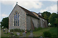
St Peter, Lindsey - north-eastern elevation
Most of the church dates from the early C14 and remains unspoiled by subsequent modernisation. The west tower was removed in 1836 and replaced with a weather-boarded turret.
Image: © David Kemp
Taken: 9 Jul 2022
0.11 miles
8
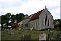
St Peter, Lindsey - south-eastern elevation
Most of the church dates from the early C14 and remains unspoiled by subsequent modernisation. The west tower was removed in 1836 and replaced with a weather-boarded turret.
Image: © David Kemp
Taken: 9 Jul 2022
0.11 miles
9
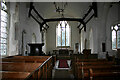
St Peter, Lindsey - interior looking east
Most of the church dates from the early C14 and remains unspoiled by subsequent modernisation.
Image: © David Kemp
Taken: 9 Jul 2022
0.12 miles
10
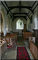
St Peter, Lindsey - interior looking west
Most of the church dates from the early C14 and remains unspoiled by subsequent modernisation.
Image: © David Kemp
Taken: 9 Jul 2022
0.12 miles