1
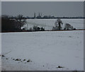
Offton Road
Heading away from Elmsett towards Offton and Somersham.
Image: © Robin Webster
Taken: 17 Jun 2017
0.03 miles
2
Offton Road
Image: © Oxymoron
Taken: 30 Jun 2009
0.12 miles
3
Bushey Ley Farm
Bushey Ley Farm near to Elmsett, Suffolk.
Image: © Keith Evans
Taken: 23 Jan 2011
0.18 miles
4
Old barn at Bushey Ley Farm
Image: © Robert Edwards
Taken: 26 Mar 2007
0.19 miles
5
Fields by the Offton road
View across the open fields in the square in snowy conditions.
Image: © Andrew Hill
Taken: 12 Jan 2010
0.24 miles
6
Elmsett St Peter?s church
Well worth a look round inside the church, although a half-hour will cover everything of interest. There is a scratch dial to find on the chancel window. The porch appears to be older than the church but of course, it is not. The 700-year-old gnarled timbers which guard the entrance and the door to the nave are indeed ancient.
Image: © Adrian S Pye
Taken: 6 Aug 2007
0.24 miles
7
St Peter Elmsett
The church of St Peter Elmsett Suffolk in the foreground can be seen the shadow of the Tithe memorial see http://www.geograph.org.uk/photo/975141 and http://www.geograph.org.uk/photo/975135 and for more info on the church see http://www.suffolkchurches.co.uk/elmsett.html
Image: © Keith Evans
Taken: 21 Sep 2008
0.24 miles
8
War Memorial in Elmsett church
The memorial names 11 men killed in Action in WW1. The lower plaque contains the names of 10 civilians killed.
The following is from the webpage of Elmsett school:
It was the 12th May 1941. Mr. Westren was cycling through the village on fire watch duty. Just after midnight the searchlights caught a German plane. The pilot was so scared of being shot down he dropped a 200lb bomb onto Elmsett. Mr.Westren was an eyewitness of this event.
Once he had got over the shock of a bomb landing right in front of him, he looked up and saw a girls head emerge through the top of a thatched roof! Mr. Westren climbed onto the roof and saved her. He took her to the Rose and Crown.
Unfortunately ten people died and eight houses were destroyed. http://www.elmsettschool.ik.org/news/11262255570.ikml
Image: © Adrian S Pye
Taken: 8 Apr 2015
0.24 miles
9
The Roll of Honour and War Memorial at Elmsett church
The Roll of Honour is placed in the organ gallery which is inaccessible unless you stand on a pew with a telephoto lens.
Those that failed to return are marked but can be read on the memorial: http://www.geograph.org.uk/photo/4419398
Image: © Adrian S Pye
Taken: 8 Apr 2015
0.24 miles
10
St Peter's Church, Elmsett
Set well away from the present village, but close to the Hall, the tower of this church dates from the 13th century.
Image: © Bob Jones
Taken: 20 Jun 2007
0.25 miles


