
IMAGES TAKEN NEAR TO
Church Hill, IPSWICH, IP7 6EF
Introduction
This page details the photographs taken nearby to Church Hill, IP7 6EF by members of the Geograph project.
The Geograph project started in 2005 with the aim of publishing, organising and preserving representative images for every square kilometre of Great Britain, Ireland and the Isle of Man.

There are currently over 7.5m images from over14,400 individuals and you can help contribute to the project by visiting https://www.geograph.org.uk
Image Map
Images are licensed for reuse under creativecommons.org/licenses/by-sa/2.0
Notes
- Clicking on the map will re-center to the selected point.
- The higher the marker number, the further away the image location is from the centre of the postcode.
Image Listing (194 Images Found)
Images are licensed for reuse under creativecommons.org/licenses/by-sa/2.0
Image
Details
Distance
1

Church Steps
https://historicengland.org.uk/listing/the-list/list-entry/1285508?section=official-list-entry
Image: © Sandy Gerrard
Taken: 21 Oct 2024
0.00 miles
2
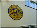
Old sign in Kersey
Once common, these old signs are not often found in situ. This is on the side of a house, just downhill from the church. The house can be seen at http://www.geograph.org.uk/photo/4151804
Image: © Marathon
Taken: 23 Aug 2014
0.01 miles
3
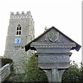
Kersey village sign
A very simple sign with the name, a date of 1987 and the arms of King’s College, Cambridge because of the connection with Kersey Priory.
The village has more history and is best known for the ford in the main street. Kersey cloth was developed here. Perhaps a best known resident was Hammond Innes the novelist. https://www.geograph.org.uk/photo/6655980
Image: © Adrian S Pye
Taken: 26 Oct 2020
0.01 miles
4
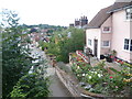
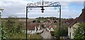
View of Kersey from the steps up to the church
Pevsner says about Kersey: "Kersey is the most picturesque village of South Suffolk. The view from the church over the tiled roofs of the houses dipping down to the ford of the River Brett and climbing up the other side is not easily forgotten."
This view looks from the steps up to St Mary's Church across the village to the far side.
Image: © Marathon
Taken: 23 Aug 2014
0.01 miles
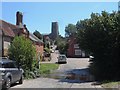
7
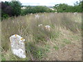
St Mary's Churchyard, Kersey
Pevsner says about Kersey: "Kersey is the most picturesque village of South Suffolk. The view from the church over the tiled roofs of the houses dipping down to the ford of the River Brett and climbing up the other side is not easily forgotten."
This view in the churchyard of St Mary's Church shows the area kept purposely unmown for the benefit of wildlife.
Image: © Marathon
Taken: 23 Aug 2014
0.01 miles
9
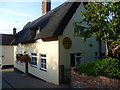
House with an old AA sign in Kersey
This is the house with the sign seen in close up at http://www.geograph.org.uk/photo/4148099 It is near the top of Church Hill.
Image: © Marathon
Taken: 23 Aug 2014
0.01 miles
10
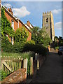
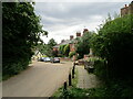
Top of Church Hill, Kersey
Housing and church tower as seen from Church Hill, Kersey
Image: © Roger Jones
Taken: 25 May 2014
0.02 miles