IMAGES TAKEN NEAR TO
Layham, IPSWICH, IP7 5RD
Introduction
This page details the photographs taken nearby to IP7 5RD by members of the Geograph project.
The Geograph project started in 2005 with the aim of publishing, organising and preserving representative images for every square kilometre of Great Britain, Ireland and the Isle of Man.

There are currently over 7.5m images from over14,400 individuals and you can help contribute to the project by visiting https://www.geograph.org.uk
Image Map
Images are licensed for reuse under creativecommons.org/licenses/by-sa/2.0
Notes
- Clicking on the map will re-center to the selected point.
- The higher the marker number, the further away the image location is from the centre of the postcode.
Image Listing (9 Images Found)
Images are licensed for reuse under creativecommons.org/licenses/by-sa/2.0
Image
Details
Distance
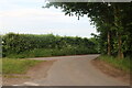
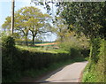
1
Road to Shelley
Road junction to Shelley near to Withermarsh Green Suffolk.
Image: © Keith Evans
Taken: 15 May 2008
0.11 miles
2
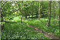
Anemonies on footpath, Shelly
A couple of public footpaths converge near Becketts Lane, Shelley.
Image: © Roger Jones
Taken: 4 May 2015
0.12 miles
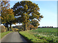
3
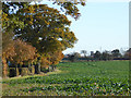
Field south of lane towards Lower Layham
Probably sugar beet, it is certainly grown in this area - see Image
Image: © Robin Webster
Taken: 19 Nov 2017
0.12 miles
4
Lane corner near Portman's Farm
A particularly twisty lane in a deeply rural corner of Suffolk.
Image: © Andrew Hill
Taken: 21 Apr 2009
0.15 miles
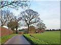
5
Country lane
Heading towards Lower Layham.
Image: © Robin Webster
Taken: 19 Nov 2017
0.17 miles
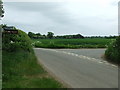
6
Country lane
This was signposted to Shelley, but if you don't turn off you end up at Layham.
Image: © Robin Webster
Taken: 13 Jan 2016
0.18 miles
7
Towards Portman's Farm
A reprieve from the high hedges on either side of the lane.
Image: © Andrew Hill
Taken: 21 Apr 2009
0.21 miles
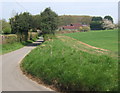
8

Distinct footpath
A clearly defined path through the growing wheat. It just cuts off a corner of the lane.
Image: © Andrew Hill
Taken: 21 Apr 2009
0.21 miles