IMAGES TAKEN NEAR TO
Hollow Lane, IPSWICH, IP6 9UE
Introduction
This page details the photographs taken nearby to Hollow Lane, IP6 9UE by members of the Geograph project.
The Geograph project started in 2005 with the aim of publishing, organising and preserving representative images for every square kilometre of Great Britain, Ireland and the Isle of Man.

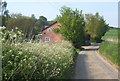
There are currently over 7.5m images from over14,400 individuals and you can help contribute to the project by visiting https://www.geograph.org.uk
Image Map
Images are licensed for reuse under creativecommons.org/licenses/by-sa/2.0
Notes
- Clicking on the map will re-center to the selected point.
- The higher the marker number, the further away the image location is from the centre of the postcode.
Image Listing (42 Images Found)
Images are licensed for reuse under creativecommons.org/licenses/by-sa/2.0
Image
Details
Distance
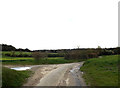
2
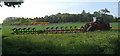
Giant farm machinery by lane to Coddenham Green
Image: © Andrew Hill
Taken: 5 May 2008
0.03 miles
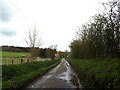
3
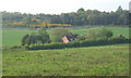
Fields looking to house by lane to Coddenham Green
Image: © Andrew Hill
Taken: 5 May 2008
0.05 miles
4
The Hollows, Coddenham Green
Near the Bridleway
Image: © Geographer
Taken: 12 Apr 2016
0.06 miles
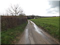
5
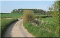
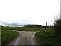
Approaching a corner in the lane to Coddenham Green
Image: © Andrew Hill
Taken: 5 May 2008
0.06 miles
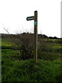
10
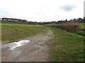
Bridleway to Dial Farm & The Hollows
Off The Hollows
Image: © Geographer
Taken: 12 Apr 2016
0.07 miles