IMAGES TAKEN NEAR TO
Pearl Close, IPSWICH, IP6 9QP

Introduction

This page details the photographs taken nearby to Pearl Close, IP6 9QP by members of the Geograph project.

The Geograph project started in 2005 with the aim of publishing, organising and preserving representative images for every square kilometre of Great Britain, Ireland and the Isle of Man.

There are currently over 7.5m images from over14,400 individuals and you can help contribute to the project by visiting https://www.geograph.org.uk

Image Map


Images are licensed for reuse under creativecommons.org/licenses/by-sa/2.0
Notes
  • Clicking on the map will re-center to the selected point.
  • The higher the marker number, the further away the image location is from the centre of the postcode.

Image Listing (101 Images Found)

Images are licensed for reuse under creativecommons.org/licenses/by-sa/2.0
  • ...
Image
Details
Distance
1
Otley Village Store & Post Office
Chapel Road
Image: © Geographer Taken: 5 Sep 2011
0.03 miles
2
Pearl Close sign
Image: © Geographer Taken: 8 Sep 2011
0.04 miles
3
Pearl Close, Otley
At the junction with Chapel Road
Image: © Geographer Taken: 8 Sep 2011
0.04 miles
4
Chapel Road, Otley
At the junction with Pearl Close
Image: © Geographer Taken: 8 Sep 2011
0.04 miles
5
Chapel Road, Otley
At the junction with Vine Road
Image: © Geographer Taken: 8 Sep 2011
0.05 miles
6
Vine Road, Otley
At the junction with Chapel Road
Image: © Geographer Taken: 8 Sep 2011
0.06 miles
7
Otley Post Office and Store. Chapel Road
Image: © Martin Dawes Taken: 23 Jun 2022
0.06 miles
8
Otley Post Office & Village Store
On Chapel Road near the junction with the B1079 Church Road
Image: © Geographer Taken: 13 Jan 2009
0.06 miles
9
TravelSafe coach depot, Otley (Suffolk)
TravelSafe operate private hire and schools services from this depot in Chapel Road. The premises were formerly those of Soames Coaches.
Image: © David Kemp Taken: 20 Sep 2019
0.07 miles
10
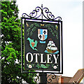
Otley village sign
The village sign stands behind the village War Memorial. The sign depicted the Gosnold Crest. Otley Hall, a 16th-century, Grade I listed house was historically the seat of the family of Bartholomew Gosnold. The sailing barque “Godspeed”, under Captain Bartholomew Gosnold, was one of the three ships (along with Susan Constant and Discovery) on the 1606–1607 voyage to the New World for the English Virginia Company of London. The journey resulted in the founding of Jamestown in the new Colony of Virginia. The wheatsheaf represents corn, and the grapes which also made the journey, and from which settlers established farming and vineyards in North America. Other elements of the sign, oak leaves, wild rose and the birds and butterfly, convey a picture of the natural history of the Otley Area. https://www.geograph.org.uk/photo/5445210
Image: © Adrian S Pye Taken: 29 Jun 2017
0.07 miles
  • ...