IMAGES TAKEN NEAR TO
Otley, IPSWICH, IP6 9PD
Introduction
This page details the photographs taken nearby to IP6 9PD by members of the Geograph project.
The Geograph project started in 2005 with the aim of publishing, organising and preserving representative images for every square kilometre of Great Britain, Ireland and the Isle of Man.

There are currently over 7.5m images from over14,400 individuals and you can help contribute to the project by visiting https://www.geograph.org.uk
Image Map
Images are licensed for reuse under creativecommons.org/licenses/by-sa/2.0
Notes
- Clicking on the map will re-center to the selected point.
- The higher the marker number, the further away the image location is from the centre of the postcode.
Image Listing (16 Images Found)
Images are licensed for reuse under creativecommons.org/licenses/by-sa/2.0
Image
Details
Distance
1
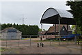
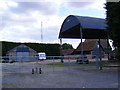
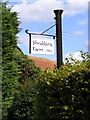
Dutch barn at Shrubbery Farm, Otley Green
Image: © Simon Mortimer
Taken: 26 May 2019
0.02 miles
7
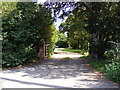
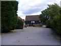
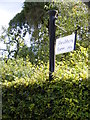
The Entrance to Two Hoots Farmhouse
Chapel Road
Image: © Geographer
Taken: 5 Sep 2011
0.05 miles
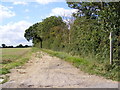
10
Footpath And Sign
Footpath sign and footpath off minor road near to Otley, Suffolk.
Image: © Keith Evans
Taken: 8 Sep 2013
0.11 miles