IMAGES TAKEN NEAR TO
Jacks Field, IPSWICH, IP6 9FA
Introduction
This page details the photographs taken nearby to Jacks Field, IP6 9FA by members of the Geograph project.
The Geograph project started in 2005 with the aim of publishing, organising and preserving representative images for every square kilometre of Great Britain, Ireland and the Isle of Man.

There are currently over 7.5m images from over14,400 individuals and you can help contribute to the project by visiting https://www.geograph.org.uk
Image Map
Images are licensed for reuse under creativecommons.org/licenses/by-sa/2.0
Notes
- Clicking on the map will re-center to the selected point.
- The higher the marker number, the further away the image location is from the centre of the postcode.
Image Listing (60 Images Found)
Images are licensed for reuse under creativecommons.org/licenses/by-sa/2.0
Image
Details
Distance
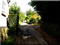
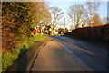
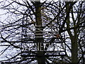
1
B1077 The Street, Witnesham
Looking towards Westerfield near the junction with Giles Way
Image: © Geographer
Taken: 19 Jan 2009
0.03 miles
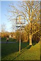
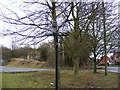
5
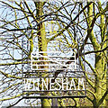
Witnesham village sign
Unfortunately located without regard to the background and therefore not only difficult to find, but difficult to see what is on it.
Probably made locally and constructed of wrought iron, the sign depicts a yellow sheaf of wheat in homage to the arable farming over many centuries, and pink pigs peering through a white five bar gate which related to the National Pig Association which operates from within the parish. https://www.geograph.org.uk/photo/4295635
Image: © Adrian S Pye
Taken: 2 Apr 2007
0.04 miles
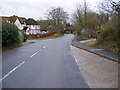
6
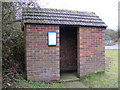
Witnesham Bus Shelter
On B1077 The Street
Image: © Geographer
Taken: 19 Jan 2009
0.04 miles
7
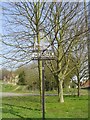
Witnesham Village Sign
On the B1077 The Street
(Close up)
Image: © Geographer
Taken: 19 Jan 2009
0.04 miles
8
Witnesham Village Sign
On the B1077 The Street
Image: © Geographer
Taken: 19 Jan 2009
0.04 miles
9
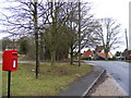
Witnesham Village Sign & Post Office, High Street, Postbox
Near the junction with Tunddenhum Lane
Postbox No.IP6 1213
Image: © Geographer
Taken: 19 Jan 2009
0.04 miles