IMAGES TAKEN NEAR TO
Cockfield Hall Lane, IPSWICH, IP6 9AN
Introduction
This page details the photographs taken nearby to Cockfield Hall Lane, IP6 9AN by members of the Geograph project.
The Geograph project started in 2005 with the aim of publishing, organising and preserving representative images for every square kilometre of Great Britain, Ireland and the Isle of Man.

There are currently over 7.5m images from over14,400 individuals and you can help contribute to the project by visiting https://www.geograph.org.uk
Image Map
Images are licensed for reuse under creativecommons.org/licenses/by-sa/2.0
Notes
- Clicking on the map will re-center to the selected point.
- The higher the marker number, the further away the image location is from the centre of the postcode.
Image Listing (10 Images Found)
Images are licensed for reuse under creativecommons.org/licenses/by-sa/2.0
Image
Details
Distance
1
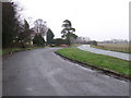
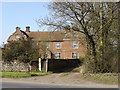
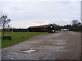
Lay-by
Lay-by on the B1077 near to Westerfield looking north.
Image: © Keith Evans
Taken: 21 Jan 2010
0.11 miles
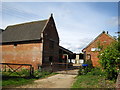
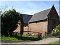
4
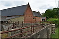
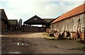
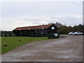
Brick barns at Westerfield Hall Farm
Image: © Simon Mortimer
Taken: 26 May 2019
0.14 miles
8
Fynn Valley Golf Driving Range
Off Witnesham Road
Image: © Geographer
Taken: 19 Jan 2009
0.24 miles
9
Fynn Valley Golf Club
Off Witnesham Road
Image: © Geographer
Taken: 19 Jan 2009
0.24 miles