1
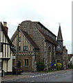
Lane between the High Street and King William Street, Needham Market
The church of St. John the Baptist on the left. The house facing the camera is fargment of a larger sixteenth century building https://historicengland.org.uk/listing/the-list/list-entry/1253683?section=official-listing
Image: © Jonathan Thacker
Taken: 3 Aug 2021
0.01 miles
2
National School Board Building
The former 19th century market town school building is now home to several local small businesses.
Image: © Stuart Shepherd
Taken: 26 Sep 2018
0.01 miles
3
B1113 High Street, Needham Market
At the junction with Barrett's Lane
Image: © Geographer
Taken: 2 Jun 2015
0.01 miles
4
Saint John the Baptist Church
On the B1113 High Street at the junction with King William Street
http://www.needhammarketparishchurch.org/
Image: © Geographer
Taken: 2 Jun 2015
0.01 miles
5
B1113 High Street, Needham Market
At the junction with Barrett's Lane
Image: © Geographer
Taken: 21 May 2016
0.01 miles
6
Back street view towards church
King William Street, Needham Market.
Image: © Andrew Hill
Taken: 5 Sep 2007
0.01 miles
7
Needham Market High Street
Looking north past the church at 10.30 on a bright winter morning. Going north the High Street later becomes Stowmarket Road, and southwards becomes Ipswich Road. It is a long street full of interest.
Image: © Andrew Hill
Taken: 10 Dec 2008
0.01 miles
8
High Street, Needham Market
The building closest to the camera dates from the fifteenth century https://historicengland.org.uk/listing/the-list/list-entry/1261672?section=official-listing
Image: © Jonathan Thacker
Taken: 3 Aug 2021
0.01 miles
9
Needham Market Town sign
On Barrett's Lane at the junction with the B1113 High Street
Image: © Geographer
Taken: 2 Jun 2015
0.01 miles
10
Needham Market Town sign
On Barrett's Lane at the junction with the B1113 High Street
(Close up)
Image: © Geographer
Taken: 2 Jun 2015
0.01 miles


