
IMAGES TAKEN NEAR TO
Broomfield Mews, IPSWICH, IP5 3TN
Introduction
This page details the photographs taken nearby to Broomfield Mews, IP5 3TN by members of the Geograph project.
The Geograph project started in 2005 with the aim of publishing, organising and preserving representative images for every square kilometre of Great Britain, Ireland and the Isle of Man.

There are currently over 7.5m images from over14,400 individuals and you can help contribute to the project by visiting https://www.geograph.org.uk
Image Map
Images are licensed for reuse under creativecommons.org/licenses/by-sa/2.0
Notes
- Clicking on the map will re-center to the selected point.
- The higher the marker number, the further away the image location is from the centre of the postcode.
Image Listing (60 Images Found)
Images are licensed for reuse under creativecommons.org/licenses/by-sa/2.0
Image
Details
Distance
1

Eagle Way, Martlesham
At the junction with Valiant Road looking towards Warren Lane
Image: © Geographer
Taken: 25 Feb 2011
0.10 miles
2
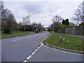
Eagle Way, Martlesham
At the junction with Valiant Road looking towards the A12 Martlesham Bypass
Image: © Geographer
Taken: 25 Feb 2011
0.10 miles
3

Valiant Road sign
At the junction with Eagle Way
Image: © Geographer
Taken: 25 Feb 2011
0.10 miles
4

Footpath off the entrance to the Control Tower Museum
Off the Grove
Image: © Geographer
Taken: 5 Mar 2012
0.13 miles
5

Control Tower Martlesham Heath
The top half of the old Control Tower at Martlesham Heath is run as a museum by the Martlesham Heath Aviation Society http://www.mhas.org.uk/
Image: © Chris Holifield
Taken: 16 May 2010
0.14 miles
6

Former Martlesham Heath Airfield Control Tower
Image: © Colin Park
Taken: 1 Oct 2017
0.15 miles
7

Survivor from Martlesham Heath airfield
This old building was obvioulsy originally part of the airfield at Martlesham Heath (a control tower, perhaps?). I think it is the building marked on the current OS map as "museum", but it now seems to be occupied by a nursery-cum-play school.
Image: © Oxymoron
Taken: 13 Jan 2009
0.15 miles
8

Martlesham Heath airfield control tower
Marked on the OS map as a museum, but now housing a playschool.
Image: © Oxymoron
Taken: 6 Apr 2009
0.15 miles
9
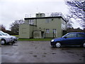
Control Tower Museum, Martlesham Heath
Off The Grove
Image: © Geographer
Taken: 5 Mar 2012
0.15 miles
10

Control Tower Museum, Martlesham Heath
Off The Grove
Image: © Geographer
Taken: 5 Mar 2012
0.15 miles