
IMAGES TAKEN NEAR TO
Betts Avenue, IPSWICH, IP5 3RY
Introduction
This page details the photographs taken nearby to Betts Avenue, IP5 3RY by members of the Geograph project.
The Geograph project started in 2005 with the aim of publishing, organising and preserving representative images for every square kilometre of Great Britain, Ireland and the Isle of Man.

There are currently over 7.5m images from over14,400 individuals and you can help contribute to the project by visiting https://www.geograph.org.uk
Image Map
Images are licensed for reuse under creativecommons.org/licenses/by-sa/2.0
Notes
- Clicking on the map will re-center to the selected point.
- The higher the marker number, the further away the image location is from the centre of the postcode.
Image Listing (79 Images Found)
Images are licensed for reuse under creativecommons.org/licenses/by-sa/2.0
Image
Details
Distance
1

Betts Avenue, Martlesham
Looking towards Gloster Road at the junction with Hawker Drive
Image: © Geographer
Taken: 11 Aug 2011
0.02 miles
2

Ex-RAF Martlesham Heath Station Commander's house
The Station Commander's house is currently used as offices for Arena Travel who specialise the Royal British Legion’s “Journeys of Remembrance” tours to the battlefields of Europe, Africa and Asia via the RBL’s own travel company, Remembrance Travel.
Image: © Adrian S Pye
Taken: 29 Jul 2016
0.03 miles

4

Aircraft Hangar
One of the large hangars at the former RAF Martlesham Heath, a major World War Two USAAF air station.
http://en.wikipedia.org/wiki/RAF_Martlesham_Heath
Image: © Tim Marchant
Taken: 27 May 2009
0.05 miles
5

Ex-Station Headquarters RAF Martlesham Heath
The old Station HQ is now the offices of Innovation Martlesham which is an established cluster of high-tech ICT companies located at Adastral Park.
Image: © Adrian S Pye
Taken: 29 Jul 2016
0.05 miles
6

Kingpin Bowling, Martlesham
Off Gloster Road
http://www.kingpinbowling.co.uk/Home.html
Image: © Geographer
Taken: 20 May 2011
0.06 miles
7

Old hangars from RAF Martlesham Heath
Now part of a nondescript industrial estate.
Image: © Oxymoron
Taken: 5 Jun 2009
0.08 miles
8
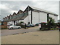
One of the old hangars of ex-RAF Martlesham Heath
The hangar is now used for light industry. The other hangar was situated where Tesco now have their supermarket (IRO TM 2475 4596)
Image: © Adrian S Pye
Taken: 29 Jul 2016
0.09 miles
9

Anson Road, Martlesham
At the junction with Betts Avenue.
Image: © Geographer
Taken: 11 Aug 2011
0.10 miles
