
IMAGES TAKEN NEAR TO
Main Road, IPSWICH, IP5 2NP
Introduction
This page details the photographs taken nearby to Main Road, IP5 2NP by members of the Geograph project.
The Geograph project started in 2005 with the aim of publishing, organising and preserving representative images for every square kilometre of Great Britain, Ireland and the Isle of Man.

There are currently over 7.5m images from over14,400 individuals and you can help contribute to the project by visiting https://www.geograph.org.uk
Image Map
Images are licensed for reuse under creativecommons.org/licenses/by-sa/2.0
Notes
- Clicking on the map will re-center to the selected point.
- The higher the marker number, the further away the image location is from the centre of the postcode.
Image Listing (93 Images Found)
Images are licensed for reuse under creativecommons.org/licenses/by-sa/2.0
Image
Details
Distance
2
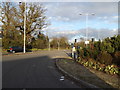
A1214 Main Road, Kesgrave
At the junction with Ropes Drive West
Image: © Geographer
Taken: 4 Feb 2014
0.04 miles
3
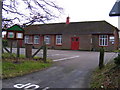
All Saints Church Hall, Kesgrave
Off the A1214 Main Road near the junction with Ropes Drive
Image: © Geographer
Taken: 24 Jan 2009
0.09 miles
4

Kesgrave War Memorial
The writing is shallow-cut, faint and almost unnoticeable but there are names on the Memorial.
A single name; F. UPSON for WW1 and 10 names; J. BELL, F. CLARKE, A. COOK, F. GIBBS, W. GIBBS, D. HAMMOND, T. MASTERSON, W. PRUTTEN, V. READ & W. RUSH for WW2.
Image: © Adrian S Pye
Taken: 23 Jun 2015
0.09 miles
5
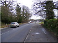
A1214 Main Road, Kesgrave
Looking towards Martlesham near the junction with Ropes Drive
Image: © Geographer
Taken: 24 Jan 2009
0.09 miles
6
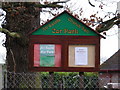
All Saints Church, Kesgrave Notice Board
Off the A1214 Main Road near the junction with Ropes Drive
Image: © Geographer
Taken: 24 Jan 2009
0.09 miles


10

Kesgrave All Saints
Although a church was recorded in the Domesday Book there is no evidence to suggest it was this church, or any part of it. Today it is a sorry sight to behold, with a carbuncle of a community centre on its backside. No doubt, some graves, which people had paid for, had to be moved to dig the footings. The cement rendering on the walls of the nave and chancel, although sound, add to the drabness of the building. It is a disappointing church from the outside although the graveyard is well kept. The tower is of red brick and of no great age. The 14th century north porch has lovely floral decoration on the hood-mould.
Image: © Adrian S Pye
Taken: 9 Jun 2007
0.12 miles