IMAGES TAKEN NEAR TO
Llewellyn Drift, IPSWICH, IP5 2DN
Introduction
This page details the photographs taken nearby to Llewellyn Drift, IP5 2DN by members of the Geograph project.
The Geograph project started in 2005 with the aim of publishing, organising and preserving representative images for every square kilometre of Great Britain, Ireland and the Isle of Man.

There are currently over 7.5m images from over14,400 individuals and you can help contribute to the project by visiting https://www.geograph.org.uk
Image Map
Images are licensed for reuse under creativecommons.org/licenses/by-sa/2.0
Notes
- Clicking on the map will re-center to the selected point.
- The higher the marker number, the further away the image location is from the centre of the postcode.
Image Listing (45 Images Found)
Images are licensed for reuse under creativecommons.org/licenses/by-sa/2.0
Image
Details
Distance
5
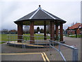
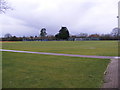
Bandstand at Kesgrave Community Centre
Off Ropes Drive
Image: © Geographer
Taken: 19 Jan 2009
0.16 miles

7

Guided bus viewed from cyclepath
Route 66 in Ipswich includes a short section of guided busway alongside National Cycle Route 1.
Image: © PeterIto
Taken: 19 Sep 2006
0.17 miles

9

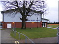
Kesgrave War Memorial Community Centre
This is a charitable trust that provides facilities such as rooms, sports and child care to the local community
Image: © steve
Taken: 24 Sep 2005
0.18 miles