
IMAGES TAKEN NEAR TO
Gwendoline Close, IPSWICH, IP4 5TT
Introduction
This page details the photographs taken nearby to Gwendoline Close, IP4 5TT by members of the Geograph project.
The Geograph project started in 2005 with the aim of publishing, organising and preserving representative images for every square kilometre of Great Britain, Ireland and the Isle of Man.

There are currently over 7.5m images from over14,400 individuals and you can help contribute to the project by visiting https://www.geograph.org.uk
Image Map
Images are licensed for reuse under creativecommons.org/licenses/by-sa/2.0
Notes
- Clicking on the map will re-center to the selected point.
- The higher the marker number, the further away the image location is from the centre of the postcode.
Image Listing (41 Images Found)
Images are licensed for reuse under creativecommons.org/licenses/by-sa/2.0
Image
Details
Distance
1
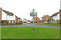
Rushmere village sign
https://www.geograph.org.uk/photo/6658421
Image: © Adrian S Pye
Taken: 30 Oct 2020
0.02 miles
3
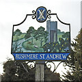
Rushmere St Andrews village sign
This is the alternative sign for Rushmere St. Andrew south of the A1214 and the housing estate built on Rushmere Heath. Illustrating a rather idyllic rural scene of a river with duck, grey heron, fox and butterflies and gorse. Standing in the meadow beyond is the water tower for the district. A strange subject to implant on an ideal landscape.
Image: © Adrian S Pye
Taken: 30 Oct 2020
0.03 miles
4
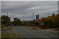
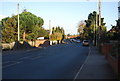
View north along Bixley Drive, Rushmere
Image: © Christopher Hilton
Taken: 5 Oct 2022
0.08 miles
5
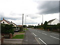
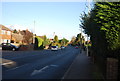
Bixley Drive, Ipswich
The water tower on Rushmere Heath is visible in the distance Image
Image: © Chris Holifield
Taken: 19 Jun 2011
0.09 miles
10
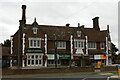
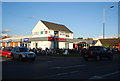
The Golf Hotel, Foxhall Road, Ipswich
The Suffolk Punch is one of a group of pubs built in the interwar years for the Tollemache brewery, known as "Tolly Follies". The architect John Shewell Corder designed them to emulate the style of Helmingham Hall, the ancestral home of the Tollemache family. (Tollemache merged with their rivals Cobbold in 1957 to form Tolly Cobbold.)
Another Ipswich Tolly Folly, the Suffolk Punch, can be seen at Image
Ipswich Golf Course lies a short distance from the hotel and many of the streets in this area of suburbia are named after golf-courses - for example, Gleneagles Drive is a short distance away.
Image: © Christopher Hilton
Taken: 5 Oct 2022
0.14 miles