IMAGES TAKEN NEAR TO
Humber Doucy Lane, IPSWICH, IP4 3NR
Introduction
This page details the photographs taken nearby to Humber Doucy Lane, IP4 3NR by members of the Geograph project.
The Geograph project started in 2005 with the aim of publishing, organising and preserving representative images for every square kilometre of Great Britain, Ireland and the Isle of Man.

There are currently over 7.5m images from over14,400 individuals and you can help contribute to the project by visiting https://www.geograph.org.uk
Image Map
Images are licensed for reuse under creativecommons.org/licenses/by-sa/2.0
Notes
- Clicking on the map will re-center to the selected point.
- The higher the marker number, the further away the image location is from the centre of the postcode.
Image Listing (32 Images Found)
Images are licensed for reuse under creativecommons.org/licenses/by-sa/2.0
Image
Details
Distance
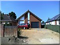
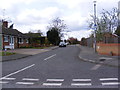
2
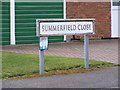
Summerfield Close sign
On Summerfield Close at the junction with Humber Doucy Lane
Image: © Geographer
Taken: 14 Apr 2012
0.09 miles
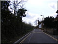
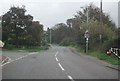
3
Sweet Shade
The end of the wonderfully named Humber Doucy Lane at Playford Road on the edge of Ipswich.
The origin of the name I got from
http://ipswich-lettering.org/streetnames.html
"...Someone told me that it comes from the French for sweet shade, which would be “ombre doucer” or something.' Thanks to Norma for the suggestion. The Anglo-Saxon 'Humbre' and the Latin verb 'umbro' suggest "to cover with shadows". The name ‘Humber Doucy’ came about in the same way that Ypres became ‘Wipers’ during World War I. And this goes back to the Napoleonic Wars (1803–1815) when Ipswich had a number of militia barracks and also played host to a number of French prisoners of war. On their hot march to and from whatever labour they were required to due during incarceration (working in the fields, perhaps?) they were grateful for the cool shade of the trees along this path/lane, so called it “ombre doucer” or possibly more correctly "ombre douce”. Sweet shade it is."
Image: © Tim Marchant
Taken: 12 Jun 2014
0.09 miles
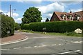
4
Humber Doucy Lane, Rushmere St.Andrew
At the junction with Summerfield Close
Image: © Geographer
Taken: 14 Apr 2012
0.09 miles
5
Summerfield Close, Rushmere St.Andrew
At the junction with Humber Doucy Lane
Image: © Geographer
Taken: 14 Apr 2012
0.09 miles
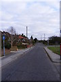
6
Humber Doucy Lane, Rushmere St.Andrew
At the junction with Playford Road
Image: © Geographer
Taken: 19 Apr 2012
0.11 miles
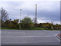
8
Playford Road
At the junction with the A1214 Woodbridge Road East
Image: © Geographer
Taken: 28 Nov 2011
0.13 miles
9
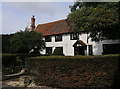
Humber Doucy House
This is a grade II listed building. See the Historic England listing at: https://www.historicengland.org.uk/listing/the-list/list-entry/1037706
Image: © Steven Fosdick
Taken: 10 Sep 2017
0.13 miles
10
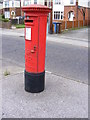
Playford Road George V Postbox
Off the A1214 Woodbridge Road East
Postbox No.IP4 1272
Image: © Geographer
Taken: 28 Nov 2011
0.14 miles