
IMAGES TAKEN NEAR TO
Russet Road, IPSWICH, IP4 2EB
Introduction
This page details the photographs taken nearby to Russet Road, IP4 2EB by members of the Geograph project.
The Geograph project started in 2005 with the aim of publishing, organising and preserving representative images for every square kilometre of Great Britain, Ireland and the Isle of Man.

There are currently over 7.5m images from over14,400 individuals and you can help contribute to the project by visiting https://www.geograph.org.uk
Image Map
Images are licensed for reuse under creativecommons.org/licenses/by-sa/2.0
Notes
- Clicking on the map will re-center to the selected point.
- The higher the marker number, the further away the image location is from the centre of the postcode.
Image Listing (86 Images Found)
Images are licensed for reuse under creativecommons.org/licenses/by-sa/2.0
Image
Details
Distance
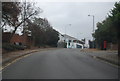
2
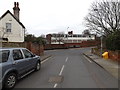
Belle Vue Road, Ipswich
At the junction with the A1071 Woodbridge Road
Image: © Geographer
Taken: 19 Feb 2015
0.10 miles
3
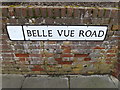
Belle Vue Road sign
On Belle Vue Road at the junction with the A1071 Woodbridge Road
Image: © Geographer
Taken: 19 Feb 2015
0.10 miles
4
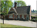
Ipswich Old Cemetery - stonemasons' workshop
Ipswich Old Cemetery is a traditional Victorian style cemetery which opened in 1855. In 1995 it was classed as a conservation area which includes the buildings, memorials and natural habitat, by the Conservation Advisory Panel. Since then, the New and Lawn cemeteries have also received similar status and in 2001 all three were added to the English Heritage Register of Parks & Gardens of Special Historic Interest. In 2009 the Old, New and Lawn cemetery were awarded Grade II listed status. The Old Cemetery has specific areas that are designated for different beliefs such as Muslim, Jewish, Quaker, CoE and Non-conformist.
Image: © Evelyn Simak
Taken: 20 Apr 2011
0.10 miles
5
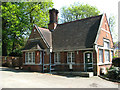
Ipswich Old Cemetery - stonemasons' workshop
Ipswich Old Cemetery is a traditional Victorian style cemetery which opened in 1855. In 1995 it was classed as a conservation area which includes the buildings, memorials and natural habitat, by the Conservation Advisory Panel. Since then, the New and Lawn cemeteries have also received similar status and in 2001 all three were added to the English Heritage Register of Parks & Gardens of Special Historic Interest. In 2009 the Old, New and Lawn cemetery were awarded Grade II listed status. The Old Cemetery has specific areas that are designated for different beliefs such as Muslim, Jewish, Quaker, CoE and Non-conformist.
Image: © Evelyn Simak
Taken: 20 Apr 2011
0.10 miles
6
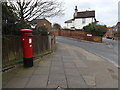
Post Mill Close Postbox
On the A1071 Woodbridge Road at the junction with Belle Vue Road
Postbox No.IP4 1142
Image: © Geographer
Taken: 19 Feb 2015
0.10 miles
7
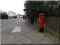
A1071 Woodbridge Road & Post Mill Close Postbox
At the junction with Belle Vue Road
Postbox No.IP4 1142
Image: © Geographer
Taken: 19 Feb 2015
0.10 miles
8
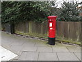
Post Mill Close Postbox
On the A1071 Woodbridge Road at the junction with Belle Vue Road
Postbox No.IP4 1142
Image: © Geographer
Taken: 19 Feb 2015
0.10 miles
9
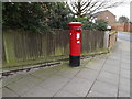
Post Mill Close Postbox
On the A1071 Woodbridge Road at the junction with Belle Vue Road
Postbox No.IP4 1142
Image: © Geographer
Taken: 19 Feb 2015
0.10 miles
10
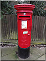
Post Mill Close Postbox
On the A1071 Woodbridge Road at the junction with Belle Vue Road
Postbox No.IP4 1142
(Close up)
Image: © Geographer
Taken: 19 Feb 2015
0.10 miles