IMAGES TAKEN NEAR TO
Dedham Place, Fore Street, IPSWICH, IP4 1JP

Introduction

This page details the photographs taken nearby to Dedham Place, Fore Street, IP4 1JP by members of the Geograph project.

The Geograph project started in 2005 with the aim of publishing, organising and preserving representative images for every square kilometre of Great Britain, Ireland and the Isle of Man.

There are currently over 7.5m images from over14,400 individuals and you can help contribute to the project by visiting https://www.geograph.org.uk

Image Map


Images are licensed for reuse under creativecommons.org/licenses/by-sa/2.0
Notes
  • Clicking on the map will re-center to the selected point.
  • The higher the marker number, the further away the image location is from the centre of the postcode.

Image Listing (538 Images Found)

Images are licensed for reuse under creativecommons.org/licenses/by-sa/2.0
  • ...
Image
Details
Distance
1
Co-Operative Education Centre
Grade II listed. http://www.britishlistedbuildings.co.uk/en-275447-co-operative-education-centre-11-ipswich
Image: © N Chadwick Taken: 18 Sep 2011
0.02 miles
2
11 Fore Street, Ipswich
Dates from the eighteenth century https://historicengland.org.uk/listing/the-list/list-entry/1374789?section=official-list-entry Now part of West Suffolk College.
Image: © Jonathan Thacker Taken: 15 May 2022
0.03 miles
3
13 - 15, Fore St
Grade II listed. http://www.britishlistedbuildings.co.uk/en-275448-13-and-15-ipswich
Image: © N Chadwick Taken: 18 Sep 2011
0.03 miles
4
Waterworks St
The A1156.
Image: © N Chadwick Taken: 18 Sep 2011
0.03 miles
5
Commemoration Buildings, Fore Street
The building is dated 1897, so presumably Martin & Newby set up somewhere else first. Currently houses a barber and a massage therapist.
Image: © Keith Edkins Taken: 5 Aug 2018
0.03 miles
6
19-23 Fore Street, Ipswich
Dates from the late seventeenth century https://historicengland.org.uk/listing/the-list/list-entry/1374790?section=official-list-entry
Image: © Jonathan Thacker Taken: 15 May 2022
0.03 miles
7
Old county gaol
Built as a gaol, until recently was the offices of Suffolk County Council.
Image: © michael wade Taken: 1 Jun 2005
0.03 miles
8
17 Fore Street, Ipswich
Possibly of the seventeenth century but refronted https://historicengland.org.uk/listing/the-list/list-entry/1037731?section=official-list-entry At one time this was the Mermaid (Meremayd) Inn.
Image: © Jonathan Thacker Taken: 15 May 2022
0.03 miles
9
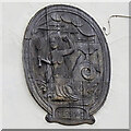
A Meremayd in Ipswich
Although this appears to be an original carving on the former Meremayd Inn, in Fore Street, Ipswich, it is in fact a copy. Dated and signed on the right hand side. M. Hardy 1974.
Image: © Adrian S Pye Taken: 25 Jul 2023
0.03 miles
10
Upper Orwell Street
Looking north from the corner of Orwell Place.
Image: © Andrew Hill Taken: 31 Aug 2009
0.03 miles
  • ...