1
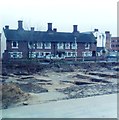
Almshouses and excavation in Ipswich
Almshouses in Foundation Street and excavation of Blackfriars Friary (now a car park) on corner with Smart Street in Ipswich. Excavations took place between 1983 and 1985.
Image: © Clint Mann
Taken: Unknown
0.03 miles
2
St. Mary at the Quay church
Taken from across the wharf, this view of St. Mary at the Quay will soon be obscured by a new building that is part of the new development around the dock area of Ipswich.
Image: © Robert Edwards
Taken: 7 Nov 2007
0.04 miles
3
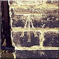
Cut Mark Ipswich Lower Brook Street
Cut Mark Ipswich Lower Brook Street, wall W face near to No 35.
Image: © Cud05
Taken: 17 May 2018
0.04 miles
4
Lower Brook Street, Ipswich
Image: © Christopher Hilton
Taken: 16 Nov 2018
0.05 miles
5
Ipswich St Mary at Quay
Is it Quay or Key, who knows? Both are used for the church and street names. There is a large key on the weather vane of the church and it is near the Quay. The church was made redundant and is cared for by the Churches Conservation Trust. It is an Arts Centre but retains the atmosphere of a church. The splendid double hammerbeam roof and clerestory offer plenty of space and light. The traditional East Anglian-type font is much defaced but an eagle, bull and lion of the evangelists can just be discerned among the heraldic angels, and round the shaft are the usual four lions. In the north aisle there is a black monument to Henry Tooley (1551) who was an important local benefactor. A short distance away, in Foundation Street, his alms houses are still standing. A bell stands by the south door, having been removed from the belfry.
Image: © Adrian S Pye
Taken: 27 Oct 2007
0.05 miles
6
First Eastern Counties - Ipswich Garage
Three buses left out in the cold.
Image: © Robin Webster
Taken: 19 Nov 2017
0.05 miles
7
Church of St Mary-at-the-Quay, Ipswich
One of a number of waterfront churches in Ipswich. Redundant, it is in the care of the Churches Conservation Trust, and is used as a performance space. http://www.visitchurches.org.uk/Ourchurches/Completelistofchurches/Church-of-St-MaryattheQuay-Ipswich-Suffolk/
Image: © Jim Osley
Taken: 19 Sep 2015
0.06 miles
8
Two church buildings, Ipswich
In the foreground, St Mary-at-the Quay: in the background, St Peter by the Waterfront.
Image: © Jim Osley
Taken: 19 Sep 2015
0.06 miles
9
Car Park
N.C.P. car park Foundation Street Ipswich Suffolk.
Image: © Keith Evans
Taken: 21 Aug 2007
0.06 miles
10
Buses at Ipswich bus garage
First Eastern Counties buses SN62AXU, EU08FHB and AU05DMF, all different models of single decker.
Image: © Robin Webster
Taken: 19 Nov 2017
0.06 miles


