
IMAGES TAKEN NEAR TO
Blackfriars Court, Foundation Street, IPSWICH, IP4 1DY
Introduction
This page details the photographs taken nearby to Blackfriars Court, Foundation Street, IP4 1DY by members of the Geograph project.
The Geograph project started in 2005 with the aim of publishing, organising and preserving representative images for every square kilometre of Great Britain, Ireland and the Isle of Man.

There are currently over 7.5m images from over14,400 individuals and you can help contribute to the project by visiting https://www.geograph.org.uk
Image Map
Images are licensed for reuse under creativecommons.org/licenses/by-sa/2.0
Notes
- Clicking on the map will re-center to the selected point.
- The higher the marker number, the further away the image location is from the centre of the postcode.
Image Listing (773 Images Found)
Images are licensed for reuse under creativecommons.org/licenses/by-sa/2.0
Image
Details
Distance
1
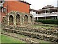
Remains of the Dominican Friary, Ipswich
This shows the remains of the sacristy https://historicengland.org.uk/listing/the-list/list-entry/1002966?section=official-list-entry
Image: © Jonathan Thacker
Taken: 15 May 2022
0.01 miles
3
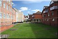
Remains of St Mary, Blackfriars, Ipswich
These are the only substantial remains of a medieval community's foundation in Ipswich. The church of the Dominicans, the Blackfriars, whose Friary of the Blessed Virgin lay to the south of Tacket Street, was excavated by archaeologists in the 1980s. New office blocks now surround the area, which has been preserved as an open green space and is a popular lunch spot for office workers in the summer.
Image: © Bob Jones
Taken: 3 Apr 2008
0.02 miles
4
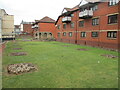
Remains of the Dominican Friary, Ipswich
Looking east along the nave of the Dominican (Blackfriars) church https://historicengland.org.uk/listing/the-list/list-entry/1002966?section=official-list-entry
Image: © Jonathan Thacker
Taken: 15 May 2022
0.02 miles
5
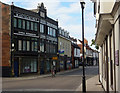
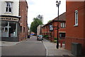
On Fore Street
Looking to the section between Lower Orwell Street coming in from the left and the crossroads at Orwell Place.
Image: © Andrew Hill
Taken: 31 Aug 2009
0.02 miles
6
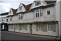
24, Fore St
Grade II* listed. http://www.britishlistedbuildings.co.uk/en-275456-24-ipswich
Image: © N Chadwick
Taken: 18 Sep 2011
0.03 miles
7
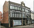
Former premises of Martin & Newby, Fore Street, Ipswich
A nineteenth century intrusion into the largely sixteenth and seventeenth century buildings of Fore Street, but a fine building in itself. Designed by T.W. Cotman https://suffolkartists.co.uk/index.cgi?choice=painter&pid=171 in 1897.
Image: © Jonathan Thacker
Taken: 15 May 2022
0.03 miles
8
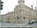
Old county gaol
Built as a gaol, until recently was the offices of Suffolk County Council.
Image: © michael wade
Taken: 1 Jun 2005
0.03 miles
9
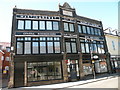
Commemoration Buildings, Fore Street
The building is dated 1897, so presumably Martin & Newby set up somewhere else first. Currently houses a barber and a massage therapist.
Image: © Keith Edkins
Taken: 5 Aug 2018
0.03 miles
10
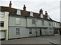
19-23 Fore Street, Ipswich
Dates from the late seventeenth century https://historicengland.org.uk/listing/the-list/list-entry/1374790?section=official-list-entry
Image: © Jonathan Thacker
Taken: 15 May 2022
0.03 miles