IMAGES TAKEN NEAR TO
Foundation Street, IPSWICH, IP4 1BE

Introduction

This page details the photographs taken nearby to Foundation Street, IP4 1BE by members of the Geograph project.

The Geograph project started in 2005 with the aim of publishing, organising and preserving representative images for every square kilometre of Great Britain, Ireland and the Isle of Man.

There are currently over 7.5m images from over14,400 individuals and you can help contribute to the project by visiting https://www.geograph.org.uk

Image Map


Images are licensed for reuse under creativecommons.org/licenses/by-sa/2.0
Notes
  • Clicking on the map will re-center to the selected point.
  • The higher the marker number, the further away the image location is from the centre of the postcode.

Image Listing (792 Images Found)

Images are licensed for reuse under creativecommons.org/licenses/by-sa/2.0
  • ...
Image
Details
Distance
1
Blackfriars, Ipswich
Remnants of the 13th to 16th century friary church and cloisters, as seen from Foundation Street.
Image: © Stuart Shepherd Taken: 25 Jan 2009
0.03 miles
2
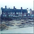
Almshouses and excavation in Ipswich
Almshouses in Foundation Street and excavation of Blackfriars Friary (now a car park) on corner with Smart Street in Ipswich. Excavations took place between 1983 and 1985.
Image: © Clint Mann Taken: Unknown
0.03 miles
3
Remains of St Mary, Blackfriars, Ipswich
These are the only substantial remains of a medieval community's foundation in Ipswich. The church of the Dominicans, the Blackfriars, whose Friary of the Blessed Virgin lay to the south of Tacket Street, was excavated by archaeologists in the 1980s. New office blocks now surround the area, which has been preserved as an open green space and is a popular lunch spot for office workers in the summer.
Image: © Bob Jones Taken: 3 Apr 2008
0.04 miles
4
Remains of the Dominican Friary, Ipswich
This shows the remains of the sacristy https://historicengland.org.uk/listing/the-list/list-entry/1002966?section=official-list-entry
Image: © Jonathan Thacker Taken: 15 May 2022
0.04 miles
5
Lower Orwell St
Image: © N Chadwick Taken: 18 Sep 2011
0.04 miles
6
Remains of the Dominican Friary, Ipswich
Looking east along the nave of the Dominican (Blackfriars) church https://historicengland.org.uk/listing/the-list/list-entry/1002966?section=official-list-entry
Image: © Jonathan Thacker Taken: 15 May 2022
0.05 miles
7
Car Park
N.C.P. car park Foundation Street Ipswich Suffolk.
Image: © Keith Evans Taken: 21 Aug 2007
0.05 miles
8
Car Park
N.C.P. car park Foundation Street Ipswich Suffolk.
Image: © Keith Evans Taken: 21 Aug 2007
0.05 miles
9
Fore Street, Ipswich
Image: © Jim Osley Taken: 19 Sep 2015
0.05 miles
10
24 Fore Street, Ipswich
A fine seventeenth century house https://historicengland.org.uk/listing/the-list/list-entry/1374792?section=official-list-entry
Image: © Jonathan Thacker Taken: 15 May 2022
0.05 miles
  • ...