
IMAGES TAKEN NEAR TO
Newmarket Road, BURY ST. EDMUNDS, IP33 3TF
Introduction
This page details the photographs taken nearby to Newmarket Road, IP33 3TF by members of the Geograph project.
The Geograph project started in 2005 with the aim of publishing, organising and preserving representative images for every square kilometre of Great Britain, Ireland and the Isle of Man.

There are currently over 7.5m images from over14,400 individuals and you can help contribute to the project by visiting https://www.geograph.org.uk
Image Map
Images are licensed for reuse under creativecommons.org/licenses/by-sa/2.0
Notes
- Clicking on the map will re-center to the selected point.
- The higher the marker number, the further away the image location is from the centre of the postcode.
Image Listing (17 Images Found)
Images are licensed for reuse under creativecommons.org/licenses/by-sa/2.0
Image
Details
Distance
1
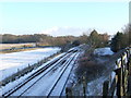
Snow covered tracks
A sprinkling of snow on the railway line as seen from the road bridge with the A14 running parallel to the left at Bury St. Edmunds, Suffolk.
Image: © Keith Evans
Taken: 1 Jan 2010
0.05 miles
3
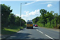
A1302 Newmarket Road, Bury St Edmunds
Leaving the town behind and approaching a roundabout where the route west joins the A14.
Image: © Robin Webster
Taken: 3 Jun 2018
0.18 miles
4
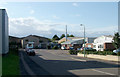
Western Way West
This little stub off the main part of Western Way houses a dairy at the end of the road, the former Miro Press printers and a company that puts the glossy lamination on cardboard products (remember LP sleeves?)
Image: © John Goldsmith
Taken: 3 Sep 2008
0.18 miles
5
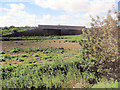
Railway Bridge carrying A1302 over line
This is at the A14 junction opposite the Golf Club
Image: © John Firth
Taken: 17 Sep 2010
0.19 miles
9
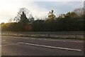
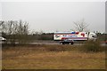
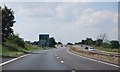
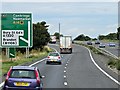
The A14, Bury St Edmunds
Bury St Edmunds Golf Club is behind the trees.
Image: © David Howard
Taken: 17 Apr 2022
0.22 miles
10
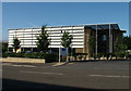
Havebury Housing, Western Way West
The striking post-2000 building houses the organisation that now runs Bury St. Edmunds' former council housing. The south wall has a spaced off set of moving shutters to control the light and heat to the building.
Image: © John Goldsmith
Taken: 3 Sep 2008
0.23 miles