
IMAGES TAKEN NEAR TO
Westley Road, BURY ST. EDMUNDS, IP33 3RU
Introduction
This page details the photographs taken nearby to Westley Road, IP33 3RU by members of the Geograph project.
The Geograph project started in 2005 with the aim of publishing, organising and preserving representative images for every square kilometre of Great Britain, Ireland and the Isle of Man.

There are currently over 7.5m images from over14,400 individuals and you can help contribute to the project by visiting https://www.geograph.org.uk
Image Map
Images are licensed for reuse under creativecommons.org/licenses/by-sa/2.0
Notes
- Clicking on the map will re-center to the selected point.
- The higher the marker number, the further away the image location is from the centre of the postcode.
Image Listing (27 Images Found)
Images are licensed for reuse under creativecommons.org/licenses/by-sa/2.0
Image
Details
Distance
1
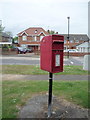
Elizabeth II postbox on Westley Road, Bury St Edmunds
Image: © JThomas
Taken: 21 May 2016
0.07 miles
2
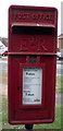
Close up, Elizabeth II postbox on Westley Road, Bury St Edmunds
Postbox No. IP33 2221.
See Image] for wider view.
Image: © JThomas
Taken: 21 May 2016
0.07 miles
3
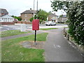
Westley Road, Bury St Edmunds
Showing position of Postbox No. IP33 2221.
See Image] for postbox.
Image: © JThomas
Taken: 21 May 2016
0.07 miles
4
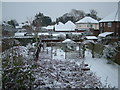
Snowy gardens, Gainsborough Road
The houses are in Minden Drive.
The Gainsborough Road house was built 1936, but the others are much newer.
Image: © John Harris
Taken: 3 Feb 2009
0.08 miles
5
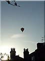
Into The Sunset
Hot air balloon drifting into the sunset over Bury St.Edmunds Suffolk.
Image: © Keith Evans
Taken: 20 Apr 2007
0.08 miles
6
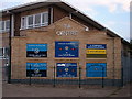
T.A. Centre
T.A. Centre Bury St.Edmunds Suffolk.
Image: © Keith Evans
Taken: 31 May 2008
0.09 miles
7
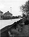
Gainsborough Road, Bury St. Edmunds, in the 1940s
The houses have not changed much, but there is no longer an unprotected lamp post in the middle of the road! Even in the 1940s it confused a US truck driver - you can see that it leans a little.
There has been some infill of extra house since this photo.
Date given is approximate.
Image: © Family heirloom, with family's permission
Taken: Unknown
0.11 miles
8
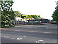
T.A. centre
T.A. centre Newmarket Road Bury St.Edmunds Suffolk.
Image: © Keith Evans
Taken: 7 May 2008
0.14 miles
9
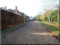
Private Road off Newmarket Road
I do not know the name of this road - it is simply marked "Private road". This area was part of a country estate before the town expanded here, with houses, barracks, and an airfield.
Image: © John Goldsmith
Taken: 20 Nov 2011
0.15 miles
10
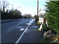
Old Milepost
Old milepost just in front of the van Newmarket Road Bury St.Edmunds, Suffolk on what was the A.45 route. For close up view see http://www.geograph.org.uk/photo/1643242
Image: © Keith Evans
Taken: 2 Jan 2010
0.16 miles