
IMAGES TAKEN NEAR TO
Hospital Road, BURY ST. EDMUNDS, IP33 3ND
Introduction
This page details the photographs taken nearby to Hospital Road, IP33 3ND by members of the Geograph project.
The Geograph project started in 2005 with the aim of publishing, organising and preserving representative images for every square kilometre of Great Britain, Ireland and the Isle of Man.

There are currently over 7.5m images from over14,400 individuals and you can help contribute to the project by visiting https://www.geograph.org.uk
Image Map
Images are licensed for reuse under creativecommons.org/licenses/by-sa/2.0
Notes
- Clicking on the map will re-center to the selected point.
- The higher the marker number, the further away the image location is from the centre of the postcode.
Image Listing (462 Images Found)
Images are licensed for reuse under creativecommons.org/licenses/by-sa/2.0
Image
Details
Distance
1
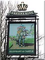
Elephant and castle pub sign
Elephant and castle pub sign Hospital road Bury St.Edmunds Suffolk.
Image: © Keith Evans
Taken: 1 Jan 2008
0.02 miles
2
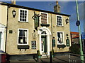
Elephant and castle
Elephant and castle public house Hospital road Bury St.Edmunds Suffolk.
Image: © Keith Evans
Taken: 12 Jan 2008
0.02 miles
3
![Bury St Edmunds buildings [259]](https://s0.geograph.org.uk/geophotos/06/70/35/6703588_5ca541cd_120x120.jpg)
Bury St Edmunds buildings [259]
Westgate Chapel is home to an evangelical church. The building was originally the stable block to a public house and has seen a number of uses before being purchased by the church in 1976.
Westgate Street is the southernmost street of the medieval grid and it is mainly about the Greene King Brewery with so many of the buildings constructed for its processes or for its employees. In addition to the brewery there is a rich mix of historic buildings in diverse materials, including white brick, red brick and stucco render. The street has the only surviving intact Regency theatre.
Bury St Edmunds is a market town which is the cultural and retail centre for West Suffolk and is known for brewing (Greene King) and sugar (British Sugar). There is scattered evidence of earlier activity but essentially Bury St Edmunds began as one of the royal boroughs of the Saxons and a monastery was founded which became the burial place of King Edmund. A new Benedictine abbey was built in 1020 which became rich and powerful and the town was laid out on a grid pattern by Abbot Baldwin. After the dissolution the abbey became ruinous. A new church, later the cathedral, was begun in the early 16th century.
Image: © Michael Dibb
Taken: 9 Sep 2020
0.02 miles
4
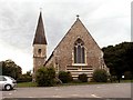
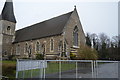
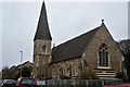
St. Peter's church
This church, designed by J. H. Hakewill, was built in 1858 and stands in Hospital Road.
Image: © Robert Edwards
Taken: 20 Aug 2008
0.03 miles
5
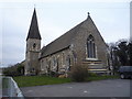
St Peter's Church, Bury St Edmunds
On Hospital Road.
Image: © JThomas
Taken: 19 Mar 2016
0.03 miles
8
![Bury St Edmunds houses [324]](https://s1.geograph.org.uk/geophotos/06/70/30/6703081_87a369c2_120x120.jpg)
Bury St Edmunds houses [324]
Numbers 4 Hospital Road (nearest the camera) has an early 17th century core with a late 18th or early 19th century brick front. Part timber framed. Listed, grade II, with details at: https://historicengland.org.uk/listing/the-list/list-entry/1022557
Number 6 Hospital Road has an early 17th century core and additions in both the early and late 19th century. Timber framed and refronted in white brick in the early 19th century. Listed, grade II, with details at: https://historicengland.org.uk/listing/the-list/list-entry/1022558
Westgate Street is the southernmost street of the medieval grid and it is mainly about the Greene King Brewery with so many of the buildings constructed for its processes or for its employees. In addition to the brewery there is a rich mix of historic buildings in diverse materials, including white brick, red brick and stucco render. The street has the only surviving intact Regency theatre.
Bury St Edmunds is a market town which is the cultural and retail centre for West Suffolk and is known for brewing (Greene King) and sugar (British Sugar). There is scattered evidence of earlier activity but essentially Bury St Edmunds began as one of the royal boroughs of the Saxons and a monastery was founded which became the burial place of King Edmund. A new Benedictine abbey was built in 1020 which became rich and powerful and the town was laid out on a grid pattern by Abbot Baldwin. After the dissolution the abbey became ruinous. A new church, later the cathedral, was begun in the early 16th century.
Image: © Michael Dibb
Taken: 9 Sep 2020
0.03 miles
9
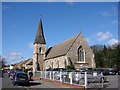
Bury St Edmunds, St Peter?s church
Built in the 1850s and recently modernised it is, unlike most other churches in Bury, locked against the visitor.
Image: © Adrian S Pye
Taken: 30 Sep 2007
0.04 miles
10
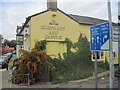
Elephant and Castle Hospital Road
Viewrd from junction Cullum Road and Out Westgate
Image: © John Firth
Taken: 16 Sep 2010
0.04 miles