
IMAGES TAKEN NEAR TO
Houghton Way, IP33 3FX
Introduction
This page details the photographs taken nearby to Houghton Way, IP33 3FX by members of the Geograph project.
The Geograph project started in 2005 with the aim of publishing, organising and preserving representative images for every square kilometre of Great Britain, Ireland and the Isle of Man.

There are currently over 7.5m images from over14,400 individuals and you can help contribute to the project by visiting https://www.geograph.org.uk
Image Map
Images are licensed for reuse under creativecommons.org/licenses/by-sa/2.0
Notes
- Clicking on the map will re-center to the selected point.
- The higher the marker number, the further away the image location is from the centre of the postcode.
Image Listing (352 Images Found)
Images are licensed for reuse under creativecommons.org/licenses/by-sa/2.0
Image
Details
Distance
1
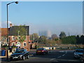
British Sugar factory in its own mist
It was a somewhat misty day but at this point the factory was enveloped in a mist of its own making, coming from the factory chimney.
It is commonly known as the Sugar Beet Factory, or the Sugar Factory, even though it makes neither. The stuff coming out of the chimney gets called steam or smoke and neither of those are right either - a small child that described it as the cloud factory was largely right.
In the foreground we see the junction of Springfield Road and Spring Lane, and behind that the site of the demolished garage of Opus Cars, which features extensively in Geograph.
To the right of the sugar refinery we can see the walkways of a fully descended gas holder.
Image: © John Goldsmith
Taken: 20 Nov 2011
0.03 miles
2
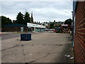
Osier Road off Tayfen Road
St. John's church spire features on the skyline.
The blue construction in the foreground is an assembly of pallets to keep people off a broken up section of concrete - it looked rather permanent.
It's a furniture shop on the left and a furniture warehouse on the right - but I never see any sign of customers at either.
Image: © John Goldsmith
Taken: 1 Aug 2010
0.04 miles
3
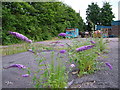
Rear of shop, Osier Road
The tall hedge hides a gas holder, but not the tall spire of St. John's church.
Image: © John Goldsmith
Taken: 1 Aug 2010
0.04 miles
4
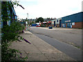
Osier Road, run down warehousing
This road is not very old but is already looking unloved, with broken surfaces and growing weeds - though they are quite pretty weeds.
Image: © John Goldsmith
Taken: 1 Aug 2010
0.04 miles
5
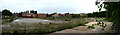
Tayfen estate seen across demolition site
A 4 picture panorama, this picture covers around 90 degrees of field. There used to be a car showroom and repair garage on this site.
Image: © John Goldsmith
Taken: 21 Aug 2011
0.05 miles
6
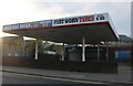
Car wash on Tayfen Road, Bury St Edmunds
Image: © David Howard
Taken: 17 Apr 2022
0.05 miles
7
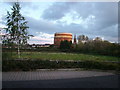
The worst cricket pitch in the world
OK, the Railway Sports Club closed several years ago, leaving their pitch to grow wild. The even taller weeds to the left were the actual wicket. The gasholder in Tayfen Road and the St. John's Church spire (not surprisingly located in St. John's Street) are both Bury landmarks.
The foreground shows a little of the Tayfen estate. The stream from the Tayfen lake passes round the right of the pitch before disappearing under Tayfen Road - and never reappearing.
Image: © John Goldsmith
Taken: 29 Oct 2008
0.05 miles
8
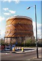
Gasholder, Bury St Edmunds
Many similar gasholders in the UK have been dismantled, but this one remains, in Tayfen Road, Bury St Edmunds, either as a local landmark or an eyesore, depending on your point of view.
Image: © Bob Jones
Taken: 31 Mar 2008
0.06 miles
9
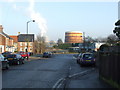
Springfield road
Looking east along Springfield Road Bury St.Edmunds Suffolk.
Image: © Keith Evans
Taken: 30 Dec 2008
0.06 miles
10
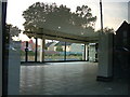
Through the showroom
The Tayfen estate is viewed through the disused showroom of Opus Cars, while the trees of Tayfen Road and Block 1, Trinity Mews, are visible reflected in the window. This space formerly housed Ferraris and Porsches.
Image: © John Goldsmith
Taken: 7 Oct 2008
0.06 miles