
IMAGES TAKEN NEAR TO
York Road, BURY ST. EDMUNDS, IP33 3EQ
Introduction
This page details the photographs taken nearby to York Road, IP33 3EQ by members of the Geograph project.
The Geograph project started in 2005 with the aim of publishing, organising and preserving representative images for every square kilometre of Great Britain, Ireland and the Isle of Man.

There are currently over 7.5m images from over14,400 individuals and you can help contribute to the project by visiting https://www.geograph.org.uk
Image Map
Images are licensed for reuse under creativecommons.org/licenses/by-sa/2.0
Notes
- Clicking on the map will re-center to the selected point.
- The higher the marker number, the further away the image location is from the centre of the postcode.
Image Listing (106 Images Found)
Images are licensed for reuse under creativecommons.org/licenses/by-sa/2.0
Image
Details
Distance
1
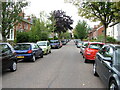
York Road, Bury St. Edmunds
It is a shame the Victorians who built this street did not make provision for each house to have carriage parking - the result in the 21st century is a car parking and 2-way traffic nightmare.
Image: © John Goldsmith
Taken: 4 Sep 2009
0.09 miles
2
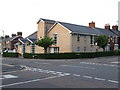
West Road Church
West Road Church on the corner of West Road and Queens Road Bury St.Edmunds Suffolk.
Image: © Keith Evans
Taken: 24 May 2008
0.09 miles
3
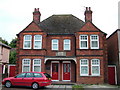
Suffolk Regiment Cottages
These cottages commemorate the South African War (Boer War) 1899 - 1902. In the centre of Bury St. Edmunds there is a statue to the dead in that war, which you can see here Image The plaques on the front of the cottages can be seen at Image
Image: © John Goldsmith
Taken: 6 Sep 2008
0.09 miles
4
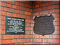
Plaques, Suffolk Regiment homes
Plaques old and new give details of the cottages seen at Image
Image: © John Goldsmith
Taken: 8 Sep 2008
0.10 miles
5
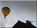
Evening Flight
Hot air balloon seen early evening over Bury St.Edmunds, Suffolk.
Image: © Keith Evans
Taken: 8 Aug 2009
0.10 miles
6
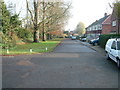
Private Road off Newmarket Road
As noted in the picture showing the view west from this same point Image, this private road has no displayed name. Note that this eastern half has a tarmac surface, unlike the western part. The road runs parallel to Newmarket Road, just separated by a hedge and small bank.
Over the trees at the end we can see the turret on top of the garage on the corner. In the 1930s this functioned not only for cars but also for refuelling aircraft on the airfield established just west of here.
To my surprise the clock on the turret was showing the correct time, which it has not done for years.
Image: © John Goldsmith
Taken: 20 Nov 2011
0.10 miles
7
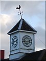
Cockerel on the cock on the clock
Cockerel weather vane on top of a clock tower on the Murco petrol garage Bury St.Edmunds Suffolk.
Image: © Keith Evans
Taken: 2 Dec 2007
0.11 miles
8
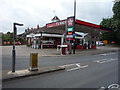
Service station on Out Risbygate, Bury St Edmunds
Home of the Royal Anglian Regiment.
Image: © JThomas
Taken: 21 May 2016
0.11 miles
9
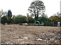
Groundworks for care home extension
The care home, St. Peter's House, is being extended by building on the former garage site next door. There are several Geograph photos of the garage demolition. Work has now started on the groundworks for the new build. In the corner one of the owners is having a conversation with a builder.
I'm a bit puzzled by the yellow tracked vehicle - it does not seem to have any facility to dig or carry or push soil.
Image: © John Goldsmith
Taken: 5 Nov 2011
0.11 miles
10
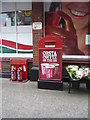
Postbox cunningly disguised as an advertisement
Postbox No. IP33 8159 at a service station on Out Risbygate, Bury St Edmunds.
See Image] for context.
Image: © JThomas
Taken: 21 May 2016
0.11 miles