
IMAGES TAKEN NEAR TO
Kings Road, BURY ST. EDMUNDS, IP33 3DE
Introduction
This page details the photographs taken nearby to Kings Road, IP33 3DE by members of the Geograph project.
The Geograph project started in 2005 with the aim of publishing, organising and preserving representative images for every square kilometre of Great Britain, Ireland and the Isle of Man.

There are currently over 7.5m images from over14,400 individuals and you can help contribute to the project by visiting https://www.geograph.org.uk
Image Map
Images are licensed for reuse under creativecommons.org/licenses/by-sa/2.0
Notes
- Clicking on the map will re-center to the selected point.
- The higher the marker number, the further away the image location is from the centre of the postcode.
Image Listing (903 Images Found)
Images are licensed for reuse under creativecommons.org/licenses/by-sa/2.0
Image
Details
Distance
1
![Bury St Edmunds houses [333]](https://s1.geograph.org.uk/geophotos/06/70/40/6704049_5addd840_120x120.jpg)
Bury St Edmunds houses [333]
Number 1 King's Road is late 18th or early 19th century, timber framed, refronted in white brick. The canted bay windows are early 20th century. Listed, grade II, with details at: https://historicengland.org.uk/listing/the-list/list-entry/1022565
Much of the centre of the town has suffered from redevelopment and most buildings are later than the mid 19th century. There are some uninspiring modern buildings along Parkway and the Arc shopping centre is particularly ugly, especially the building occupied by Debenhams.
Bury St Edmunds is a market town which is the cultural and retail centre for West Suffolk and is known for brewing (Greene King) and sugar (British Sugar). There is scattered evidence of earlier activity but essentially Bury St Edmunds began as one of the royal boroughs of the Saxons and a monastery was founded which became the burial place of King Edmund. A new Benedictine abbey was built in 1020 which became rich and powerful and the town was laid out on a grid pattern by Abbot Baldwin. After the dissolution the abbey became ruinous. A new church, later the cathedral, was begun in the early 16th century.
Image: © Michael Dibb
Taken: 12 Sep 2020
0.00 miles
2
![Bury St Edmunds houses [334]](https://s0.geograph.org.uk/geophotos/06/70/40/6704052_ba1d475c_120x120.jpg)
Bury St Edmunds houses [334]
Number 2 King's Road is 17th century, timber framed and encased in white brick. There are various rear extensions dating from the 17th to the early 19th centuries. Listed, grade II, with details at: https://historicengland.org.uk/listing/the-list/list-entry/1022567
Much of the centre of the town has suffered from redevelopment and most buildings are later than the mid 19th century. There are some uninspiring modern buildings along Parkway and the Arc shopping centre is particularly ugly, especially the building occupied by Debenhams.
Bury St Edmunds is a market town which is the cultural and retail centre for West Suffolk and is known for brewing (Greene King) and sugar (British Sugar). There is scattered evidence of earlier activity but essentially Bury St Edmunds began as one of the royal boroughs of the Saxons and a monastery was founded which became the burial place of King Edmund. A new Benedictine abbey was built in 1020 which became rich and powerful and the town was laid out on a grid pattern by Abbot Baldwin. After the dissolution the abbey became ruinous. A new church, later the cathedral, was begun in the early 16th century.
Image: © Michael Dibb
Taken: 12 Sep 2020
0.01 miles
3
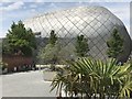
Public space next to Debenhams, Bury St Edmunds
Image: © Richard Humphrey
Taken: 27 May 2018
0.02 miles
4

Cloud inversion
A severe rain storm had just passed over and the setting sun was reflecting in this strange cloud formation, looking eastwards from the Waitrose car park in Bury St Edmunds.
Image: © Bob Jones
Taken: 17 Jan 2008
0.03 miles
6
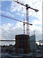
Constructing
Constructing the new shopping development called the Arc at Bury St.Edmunds Suffolk. More info see http://arc-burystedmunds.com/default.aspx
Image: © Keith Evans
Taken: 24 Jul 2007
0.04 miles
8
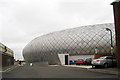
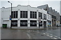
Rear of Debenhams, Arc Shopping Centre, Bury St Edmunds, Suffolk
Opened March 2009. Part of a modern shopping complex. http://www.arc-burystedmunds.com/
Also see Image
Image: © Oast House Archive
Taken: 15 Aug 2009
0.05 miles
10
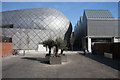
Entrance to 'arc' shopping development
The new shopping development in the centre of Bury St Edmunds http://www.arc-burystedmunds.com/ can be accessed from a number of directions. This entrance is from King's Road, to the south.
Image: © Bob Jones
Taken: 18 Mar 2009
0.05 miles