
IMAGES TAKEN NEAR TO
Pemberton Walk, BURY ST. EDMUNDS, IP33 2PE
Introduction
This page details the photographs taken nearby to Pemberton Walk, IP33 2PE by members of the Geograph project.
The Geograph project started in 2005 with the aim of publishing, organising and preserving representative images for every square kilometre of Great Britain, Ireland and the Isle of Man.

There are currently over 7.5m images from over14,400 individuals and you can help contribute to the project by visiting https://www.geograph.org.uk
Image Map
Images are licensed for reuse under creativecommons.org/licenses/by-sa/2.0
Notes
- Clicking on the map will re-center to the selected point.
- The higher the marker number, the further away the image location is from the centre of the postcode.
Image Listing (15 Images Found)
Images are licensed for reuse under creativecommons.org/licenses/by-sa/2.0
Image
Details
Distance
1

Townlane Road
As with many streets, the road gets clogged with cars in the evening. This was taken on a Saturday morning.
Image: © Greg Aspland
Taken: 22 Nov 2008
0.15 miles

3
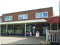
Post Office and shop, Bury St Edmunds
Off Home Farm Lane.
Image: © JThomas
Taken: 20 May 2017
0.21 miles
4
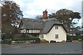
Dairy Cottage
Believed to be the only thatched roofed home left in Bury St Edmunds, this cottage was previously known as Swiss Cottage, due to its styling.
Compare with Image 1920s view.
Image: © Greg Aspland
Taken: 22 Nov 2008
0.21 miles
5
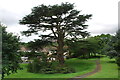
Cedar tree damaged during wet summer
The branches from this cedar tree appear to have broken in a domino effect, with an upper branch bringing down several others. It happened at around 8am on 8th July 2012.
Image: © Greg Aspland
Taken: 8 Jul 2012
0.22 miles
6
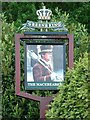
The Macebearer Pub Sign
The pub sign for the Macebearer Pub Home Farm Lane Bury St. Edmunds, Suffolk. For view of the pub see http://www.geograph.org.uk/photo/1312470
Image: © Keith Evans
Taken: 19 May 2009
0.22 miles
7
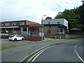
The Macebearer public house, Bury St Edmunds
Showing position of Postbox No. IP33 2052.
See Image] for postbox.
Image: © JThomas
Taken: 20 May 2017
0.22 miles
8
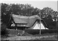
Dairy Cottage in the 1920s
Described in the 1924 sale particulars as 'built in the style of a Swiss chalet' this cottage was situated near the Home Farm. The accommodation consisted of: sitting room; kitchen; scullery; a large dairy and four bedrooms, with good garden.
Compare with Image modern day view.
Photograph courtesy of The Jarman Collection, the Bury St Edmunds Past and Present Society. http://www.BuryPastAndPresent.org.uk
Image: © Bury St Edmunds Past and Present Society
Taken: Unknown
0.23 miles
9
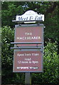
Sign for the Macebearer public house, Bury St Edmunds
Image: © JThomas
Taken: 20 May 2017
0.23 miles
10
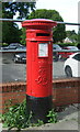
Edward VII postbox on Home Farm Lane, Bury St Edmunds
Postbox No. IP33 2052.
See Image] for context.
Image: © JThomas
Taken: 20 May 2017
0.23 miles