
IMAGES TAKEN NEAR TO
Yew Tree Court, BURY ST. EDMUNDS, IP33 2JF
Introduction
This page details the photographs taken nearby to Yew Tree Court, IP33 2JF by members of the Geograph project.
The Geograph project started in 2005 with the aim of publishing, organising and preserving representative images for every square kilometre of Great Britain, Ireland and the Isle of Man.

There are currently over 7.5m images from over14,400 individuals and you can help contribute to the project by visiting https://www.geograph.org.uk
Image Map
Images are licensed for reuse under creativecommons.org/licenses/by-sa/2.0
Notes
- Clicking on the map will re-center to the selected point.
- The higher the marker number, the further away the image location is from the centre of the postcode.
Image Listing (33 Images Found)
Images are licensed for reuse under creativecommons.org/licenses/by-sa/2.0
Image
Details
Distance
4
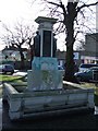
Ouida memorial
Ouida was the pen name of the English novelist Maria Louise Ramé (although she preferred to be known as Marie Louise de la Ramée). The memorial was erected from funds subscribed by readers of the Daily Mirror. For close up views see http://www.geograph.org.uk/photo/655811 , http://www.geograph.org.uk/photo/655819 ,http://www.geograph.org.uk/photo/655822 and for more info on her see http://www.stedmundsbury.gov.uk/sebc/visit/Ouida-Memorial.cfm and http://en.wikipedia.org/wiki/Ouida
Image: © Keith Evans
Taken: 12 Jan 2008
0.06 miles
5
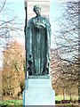
Sympathy
Close up of part of the Ouida memorial Bury St.Edmunds also see http://www.geograph.org.uk/photo/655802 , http://www.stedmundsbury.gov.uk/sebc/visit/Ouida-Memorial.cfm and http://en.wikipedia.org/wiki/Ouida
Image: © Keith Evans
Taken: 12 Jan 2008
0.06 miles
6
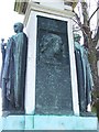
Close up of Ouida memorial
Close up of part of the Ouida memorial Bury St.Edmunds also see http://www.geograph.org.uk/photo/655802 , http://www.stedmundsbury.gov.uk/sebc/visit/Ouida-Memorial.cfm and http://en.wikipedia.org/wiki/Ouida
Image: © Keith Evans
Taken: 12 Jan 2008
0.06 miles
8
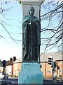
Courage
Close up of part of the Ouida memorial Bury St.Edmunds also see http://www.geograph.org.uk/photo/655802 , http://www.stedmundsbury.gov.uk/sebc/visit/Ouida-Memorial.cfm and http://en.wikipedia.org/wiki/Ouida
Image: © Keith Evans
Taken: 12 Jan 2008
0.07 miles
10
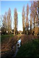
Poplars by the Linnet
The River Linnet, a tributary of the River Lark, is barely a stream at this point, in Holywater Meadows near the centre of Bury St Edmunds.
Image: © Bob Jones
Taken: 26 Feb 2008
0.07 miles