
IMAGES TAKEN NEAR TO
The Firs, Rushbrooke Lane, BURY ST. EDMUNDS, IP33 2FF
Introduction
This page details the photographs taken nearby to The Firs, Rushbrooke Lane, IP33 2FF by members of the Geograph project.
The Geograph project started in 2005 with the aim of publishing, organising and preserving representative images for every square kilometre of Great Britain, Ireland and the Isle of Man.

There are currently over 7.5m images from over14,400 individuals and you can help contribute to the project by visiting https://www.geograph.org.uk
Image Map
Images are licensed for reuse under creativecommons.org/licenses/by-sa/2.0
Notes
- Clicking on the map will re-center to the selected point.
- The higher the marker number, the further away the image location is from the centre of the postcode.
Image Listing (14 Images Found)
Images are licensed for reuse under creativecommons.org/licenses/by-sa/2.0
Image
Details
Distance

2

Road to Rushbrook from Southgate bridge roundabout
Image: © John Firth
Taken: 13 Sep 2010
0.20 miles
3

Lorry parking
Looking up Rougham Road, Bury St Edmunds, Suffolk, at lorries parked up for the night. At the top of the hill is a purpose built lorry park, I can only think it's full.
Image: © Keith Evans
Taken: 22 Jul 2008
0.20 miles
4

"The Fort", Bury St. Edmunds, glimpsed from the car park
This was the house of the governor of Bury St Edmunds jail.
Originally at the centre of radiating wings containing the prison cells.
It has now been divided into flats.
Image: © Adrian S Pye
Taken: 18 Jul 2019
0.21 miles
5
![Bury St Edmunds houses [220]](https://s1.geograph.org.uk/geophotos/06/68/45/6684537_9c359aa7_120x120.jpg)
Bury St Edmunds houses [220]
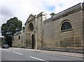
A glimpse of the house known as The Fort, number 23 Sicklesmere Road. It was built in 1803, in red brick, as the house for the governor of the gaol. The house was originally at the centre of radiating wings containing the prison cells. Now divided into flats. Listed, grade II, with details at: https://historicengland.org.uk/listing/the-list/list-entry/1135178
Sparhawk Street runs from Honey Hill via the open space of St Mary’s Square to Southgate Street which leads to Southgate Green, the site of the town’s Southgate and where St Petronella’s Hospital was located, established in the 12th century for the treatment of female lepers. The area is rich in history and has a great variety of buildings.
Bury St Edmunds is a market town which is the cultural and retail centre for West Suffolk and is known for brewing (Greene King) and sugar (British Sugar). There is scattered evidence of earlier activity but essentially Bury St Edmunds began as one of the royal boroughs of the Saxons and a monastery was founded which became the burial place of King Edmund. A new Benedictine abbey was built in 1020 which became rich and powerful and the town was laid out on a grid pattern by Abbot Baldwin. After the dissolution the abbey became ruinous. A new church, later the cathedral, was begun in the early 16th century.
Image: © Michael Dibb
Taken: 9 Sep 2020
0.21 miles
6

Golf practice area
This is one corner of the golf practice area. On the far left of the photo, just the other side of the fence, it's just possible to make out some archway like structures, where the 'marksmen' stand. The car to the right of the photo is an old Ford Escort, which no doubt has many balls in it. The high fence stops most balls escaping, but there are a few on the path outside the fence.
Image: © Greg Aspland
Taken: 18 Oct 2008
0.22 miles
7
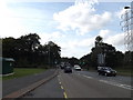
A134 Rougham Road, Bury St.Edmunds
Looking towards Southgate Bridge near the Police Investigation Centre
Image: © Geographer
Taken: 3 Oct 2014
0.22 miles

10
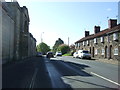
Sicklesmere Road (A134), Bury St.Edmunds
Looking south east.
Image: © JThomas
Taken: 25 Apr 2017
0.23 miles