
IMAGES TAKEN NEAR TO
Southgate Green, BURY ST. EDMUNDS, IP33 2BL
Introduction
This page details the photographs taken nearby to Southgate Green, IP33 2BL by members of the Geograph project.
The Geograph project started in 2005 with the aim of publishing, organising and preserving representative images for every square kilometre of Great Britain, Ireland and the Isle of Man.

There are currently over 7.5m images from over14,400 individuals and you can help contribute to the project by visiting https://www.geograph.org.uk
Image Map
Images are licensed for reuse under creativecommons.org/licenses/by-sa/2.0
Notes
- Clicking on the map will re-center to the selected point.
- The higher the marker number, the further away the image location is from the centre of the postcode.
Image Listing (65 Images Found)
Images are licensed for reuse under creativecommons.org/licenses/by-sa/2.0
Image
Details
Distance
1
![Bury St Edmunds houses [216]](https://s2.geograph.org.uk/geophotos/06/68/34/6683454_d0cdc425_120x120.jpg)
Bury St Edmunds houses [216]
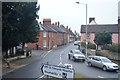
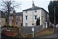
Numbers 5 and 6 Southgate Green are a pair of early 19th century houses with later additions in white brick. Number 5 has been converted into flats. The north end wall is in random flint with red brick and stone blocks and may include some material from the church attached to the medieval Hospital of St Petronilla which stood nearby. Number 5 was modernised during its conversion to flats but number 6 retains many early 19th century internal features. Listed, grade II, with details at: https://historicengland.org.uk/listing/the-list/list-entry/1272184
Sparhawk Street runs from Honey Hill via the open space of St Mary’s Square to Southgate Street which leads to Southgate Green, the site of the town’s Southgate and where St Petronella’s Hospital was located, established in the 12th century for the treatment of female lepers. The area is rich in history and has a great variety of buildings.
Bury St Edmunds is a market town which is the cultural and retail centre for West Suffolk and is known for brewing (Greene King) and sugar (British Sugar). There is scattered evidence of earlier activity but essentially Bury St Edmunds began as one of the royal boroughs of the Saxons and a monastery was founded which became the burial place of King Edmund. A new Benedictine abbey was built in 1020 which became rich and powerful and the town was laid out on a grid pattern by Abbot Baldwin. After the dissolution the abbey became ruinous. A new church, later the cathedral, was begun in the early 16th century.
Image: © Michael Dibb
Taken: 9 Sep 2020
0.00 miles
4
![Bury St Edmunds features [17]](https://s2.geograph.org.uk/geophotos/06/68/34/6683458_7b15db71_120x120.jpg)
Bury St Edmunds features [17]
On the roundabout at Southgate Green stands this sculpture of the wolf from the legend of St Edmund. The sculpture is carved from oak and it guards a steel crown resting on stones from Bury St Edmunds Abbey.
The Legend of St Edmund and the Wolf
Edmund, King of East Anglia, fought against the Danes but was captured. When he refused to give up his Christian faith the Danes tied him to a tree, shot him with arrows until he ‘bristled like a hedgehog’ and then decapitated him. The King’s men came to find his body after the battle, but they could not find his head. Hearing a cry of ‘Here, here, here’ from a nearby wood, they discovered a wolf protecting the head of the King. The wolf allowed the men to take the head and, when placed with the body, a miracle occurred and the head fused back on. This was felt to be a sign of sainthood and many miracles were then attributed to Edmund and his shrine in the Abbey of Bury St Edmunds became a place of pilgrimage.
Sparhawk Street runs from Honey Hill via the open space of St Mary’s Square to Southgate Street which leads to Southgate Green, the site of the town’s Southgate and where St Petronella’s Hospital was located, established in the 12th century for the treatment of female lepers. The area is rich in history and has a great variety of buildings.
Bury St Edmunds is a market town which is the cultural and retail centre for West Suffolk and is known for brewing (Greene King) and sugar (British Sugar). There is scattered evidence of earlier activity but essentially Bury St Edmunds began as one of the royal boroughs of the Saxons and a monastery was founded which became the burial place of King Edmund. A new Benedictine abbey was built in 1020 which became rich and powerful and the town was laid out on a grid pattern by Abbot Baldwin. After the dissolution the abbey became ruinous. A new church, later the cathedral, was begun in the early 16th century.
Image: © Michael Dibb
Taken: 9 Sep 2020
0.03 miles
5

Wolf Sculpture
Wooden Wolf sculpture on the Southgate roundabout at Bury St.Edmunds Suffolk. For more info see http://www.bbc.co.uk/news/uk-england-suffolk-25043186 and http://en.wikipedia.org/wiki/Edmund_the_Martyr for other views http://www.geograph.org.uk/photo/3755196 http://www.geograph.org.uk/photo/3755198
Image: © Keith Evans
Taken: 24 Nov 2013
0.03 miles
6
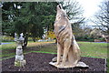
The Wolf And The Crown
Wooden Wolf sculpture on the Southgate roundabout at Bury St.Edmunds Suffolk. For more info see http://www.bbc.co.uk/news/uk-england-suffolk-25043186 and http://en.wikipedia.org/wiki/Edmund_the_Martyr for other views http://www.geograph.org.uk/photo/3755190 http://www.geograph.org.uk/photo/3755198
Image: © Keith Evans
Taken: 24 Nov 2013
0.03 miles
7
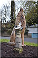
St.Edmunds Crown And The Wolf
Wooden Wolf sculpture on the Southgate roundabout at Bury St.Edmunds Suffolk. For more info see http://www.bbc.co.uk/news/uk-england-suffolk-25043186 and http://en.wikipedia.org/wiki/Edmund_the_Martyr for other views http://www.geograph.org.uk/photo/3755190 http://www.geograph.org.uk/photo/3755196
Image: © Keith Evans
Taken: 24 Nov 2013
0.03 miles
8
![Bury St Edmunds houses [202]](https://s2.geograph.org.uk/geophotos/06/68/21/6682198_406a9200_120x120.jpg)
Bury St Edmunds houses [202]
Number 71 Southgate Street is late 15th or early 16th century, timber framed and formerly jettied along the street. Refronted in red brick in the 18th century. Listed, grade II, with details at: https://historicengland.org.uk/listing/the-list/list-entry/1272138
Sparhawk Street runs from Honey Hill via the open space of St Mary’s Square to Southgate Street which leads to Southgate Green, the site of the town’s Southgate and where St Petronella’s Hospital was located, established in the 12th century for the treatment of female lepers. The area is rich in history and has a great variety of buildings.
Bury St Edmunds is a market town which is the cultural and retail centre for West Suffolk and is known for brewing (Greene King) and sugar (British Sugar). There is scattered evidence of earlier activity but essentially Bury St Edmunds began as one of the royal boroughs of the Saxons and a monastery was founded which became the burial place of King Edmund. A new Benedictine abbey was built in 1020 which became rich and powerful and the town was laid out on a grid pattern by Abbot Baldwin. After the dissolution the abbey became ruinous. A new church, later the cathedral, was begun in the early 16th century.
Image: © Michael Dibb
Taken: 9 Sep 2020
0.03 miles
9
![Bury St Edmunds features [18]](https://s0.geograph.org.uk/geophotos/06/68/34/6683464_a694d172_120x120.jpg)
Bury St Edmunds features [18]
An information board about the sculpture of the wolf on Southgate Green roundabout. Image
The Legend of St Edmund and the Wolf
Edmund, King of East Anglia, fought against the Danes but was captured. When he refused to give up his Christian faith the Danes tied him to a tree, shot him with arrows until he ‘bristled like a hedgehog’ and then decapitated him. The King’s men came to find his body after the battle, but they could not find his head. Hearing a cry of ‘Here, here, here’ from a nearby wood, they discovered a wolf protecting the head of the King. The wolf allowed the men to take the head and, when placed with the body, a miracle occurred and the head fused back on. This was felt to be a sign of sainthood and many miracles were then attributed to Edmund and his shrine in the Abbey of Bury St Edmunds became a place of pilgrimage.
Sparhawk Street runs from Honey Hill via the open space of St Mary’s Square to Southgate Street which leads to Southgate Green, the site of the town’s Southgate and where St Petronella’s Hospital was located, established in the 12th century for the treatment of female lepers. The area is rich in history and has a great variety of buildings.
Bury St Edmunds is a market town which is the cultural and retail centre for West Suffolk and is known for brewing (Greene King) and sugar (British Sugar). There is scattered evidence of earlier activity but essentially Bury St Edmunds began as one of the royal boroughs of the Saxons and a monastery was founded which became the burial place of King Edmund. A new Benedictine abbey was built in 1020 which became rich and powerful and the town was laid out on a grid pattern by Abbot Baldwin. After the dissolution the abbey became ruinous. A new church, later the cathedral, was begun in the early 16th century.
Image: © Michael Dibb
Taken: 9 Sep 2020
0.03 miles
10
![Bury St Edmunds houses [203]](https://s0.geograph.org.uk/geophotos/06/68/22/6682204_b41a399b_120x120.jpg)
Bury St Edmunds houses [203]
Weavers Rest, number 80 Southgate Street was once divided into three cottages. Built in the late 15th century and extended in the 16th century. Timber framed and jettied to the street with the ground storey stuccoed. The middle two bays are the open hall of the original house with one bay added to each side later. The north bay (right) is originally a cross wing of which the rear part has been demolished. Listed, grade II*, with details at: https://historicengland.org.uk/listing/the-list/list-entry/1272141
Sparhawk Street runs from Honey Hill via the open space of St Mary’s Square to Southgate Street which leads to Southgate Green, the site of the town’s Southgate and where St Petronella’s Hospital was located, established in the 12th century for the treatment of female lepers. The area is rich in history and has a great variety of buildings.
Bury St Edmunds is a market town which is the cultural and retail centre for West Suffolk and is known for brewing (Greene King) and sugar (British Sugar). There is scattered evidence of earlier activity but essentially Bury St Edmunds began as one of the royal boroughs of the Saxons and a monastery was founded which became the burial place of King Edmund. A new Benedictine abbey was built in 1020 which became rich and powerful and the town was laid out on a grid pattern by Abbot Baldwin. After the dissolution the abbey became ruinous. A new church, later the cathedral, was begun in the early 16th century.
Image: © Michael Dibb
Taken: 9 Sep 2020
0.04 miles