
IMAGES TAKEN NEAR TO
Rutland Square, BURY ST. EDMUNDS, IP33 2AS
Introduction
This page details the photographs taken nearby to Rutland Square, IP33 2AS by members of the Geograph project.
The Geograph project started in 2005 with the aim of publishing, organising and preserving representative images for every square kilometre of Great Britain, Ireland and the Isle of Man.

There are currently over 7.5m images from over14,400 individuals and you can help contribute to the project by visiting https://www.geograph.org.uk
Image Map
Images are licensed for reuse under creativecommons.org/licenses/by-sa/2.0
Notes
- Clicking on the map will re-center to the selected point.
- The higher the marker number, the further away the image location is from the centre of the postcode.
Image Listing (494 Images Found)
Images are licensed for reuse under creativecommons.org/licenses/by-sa/2.0
Image
Details
Distance
1
![Bury St Edmunds houses [189]](https://s2.geograph.org.uk/geophotos/06/68/10/6681006_715e097b_120x120.jpg)
Bury St Edmunds houses [189]
Originally a terrace of three houses, now two are numbers 4 and 5 Southgate Street. There is a 16th century timber framed core and, in the early 19th century the front wall was removed and the houses built forward in white brick. Listed, grade II, with details at: https://historicengland.org.uk/listing/the-list/list-entry/1272199
Sparhawk Street runs from Honey Hill via the open space of St Mary’s Square to Southgate Street which leads to Southgate Green, the site of the town’s Southgate and where St Petronella’s Hospital was located, established in the 12th century for the treatment of female lepers. The area is rich in history and has a great variety of buildings.
Bury St Edmunds is a market town which is the cultural and retail centre for West Suffolk and is known for brewing (Greene King) and sugar (British Sugar). There is scattered evidence of earlier activity but essentially Bury St Edmunds began as one of the royal boroughs of the Saxons and a monastery was founded which became the burial place of King Edmund. A new Benedictine abbey was built in 1020 which became rich and powerful and the town was laid out on a grid pattern by Abbot Baldwin. After the dissolution the abbey became ruinous. A new church, later the cathedral, was begun in the early 16th century.
Image: © Michael Dibb
Taken: 9 Sep 2020
0.04 miles
2
![Bury St Edmunds houses [193]](https://s2.geograph.org.uk/geophotos/06/68/10/6681018_a7769ea9_120x120.jpg)
Bury St Edmunds houses [193]
Number 13 Southgate Street has a 16th century rear range and a 19th century front range. Both timber framed refronted in red brick and stuccoed at the sides. Formerly The Jolly Toper public house which opened circa 1833 and closed in 1908. Listed, grade II, with details at: https://historicengland.org.uk/listing/the-list/list-entry/1272099
Sparhawk Street runs from Honey Hill via the open space of St Mary’s Square to Southgate Street which leads to Southgate Green, the site of the town’s Southgate and where St Petronella’s Hospital was located, established in the 12th century for the treatment of female lepers. The area is rich in history and has a great variety of buildings.
Bury St Edmunds is a market town which is the cultural and retail centre for West Suffolk and is known for brewing (Greene King) and sugar (British Sugar). There is scattered evidence of earlier activity but essentially Bury St Edmunds began as one of the royal boroughs of the Saxons and a monastery was founded which became the burial place of King Edmund. A new Benedictine abbey was built in 1020 which became rich and powerful and the town was laid out on a grid pattern by Abbot Baldwin. After the dissolution the abbey became ruinous. A new church, later the cathedral, was begun in the early 16th century.
Image: © Michael Dibb
Taken: 9 Sep 2020
0.05 miles
3
![Bury St Edmunds houses [191]](https://s2.geograph.org.uk/geophotos/06/68/10/6681014_353cb586_120x120.jpg)
Bury St Edmunds houses [191]
Newells, number 8 Southgate Street (nearest the camera) is 17th century, altered in the 18th century, gable end to the street, timber framed and stuccoed. The square bay is supported on wooden posts and has a small-paned former shop window. Listed, grade II, with details at: https://historicengland.org.uk/listing/the-list/list-entry/1272204
Number 9 Southgate Street is mid or late 16th century, timber framed and jettied to the street. The ground floor has been refaced with stuccoed brick. The house was greatly modernised in the 1960s. Listed, grade II, with details at: https://historicengland.org.uk/listing/the-list/list-entry/1272207
Sparhawk Street runs from Honey Hill via the open space of St Mary’s Square to Southgate Street which leads to Southgate Green, the site of the town’s Southgate and where St Petronella’s Hospital was located, established in the 12th century for the treatment of female lepers. The area is rich in history and has a great variety of buildings.
Bury St Edmunds is a market town which is the cultural and retail centre for West Suffolk and is known for brewing (Greene King) and sugar (British Sugar). There is scattered evidence of earlier activity but essentially Bury St Edmunds began as one of the royal boroughs of the Saxons and a monastery was founded which became the burial place of King Edmund. A new Benedictine abbey was built in 1020 which became rich and powerful and the town was laid out on a grid pattern by Abbot Baldwin. After the dissolution the abbey became ruinous. A new church, later the cathedral, was begun in the early 16th century.
Image: © Michael Dibb
Taken: 9 Sep 2020
0.05 miles
4
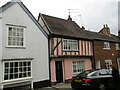
9 Southgate Street, Bury St Edmunds
Sixteenth century house https://historicengland.org.uk/listing/the-list/list-entry/1272207?section=official-list-entry
Image: © Jonathan Thacker
Taken: 16 May 2022
0.05 miles
5
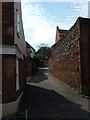
Prussia Lane, Bury St. Edmunds
The map says this is Prussia Lane, but the road itself has no sign, at this end at least. It connects Raingate Street to Southgate Street. Assuming that these road names come from the openings in the original town walls, it is surprising that two were built so close together.
The house with the tall wall is called Red Bricks - good to see that they found such a distinctive feature to inspire the name.
Image: © John Goldsmith
Taken: 3 Sep 2011
0.05 miles
6
![Bury St Edmunds houses [190]](https://s2.geograph.org.uk/geophotos/06/68/10/6681010_d00e40e0_120x120.jpg)
Bury St Edmunds houses [190]
Number 7 Southgate Street was The Three Crowns public house which opened in 1724 and closed in 1932. There is a 16th century timber framed core, refronted in white brick in the early 19th century. There is a 19th century rear extension. Listed, grade II, with details at: https://historicengland.org.uk/listing/the-list/list-entry/1272200
Sparhawk Street runs from Honey Hill via the open space of St Mary’s Square to Southgate Street which leads to Southgate Green, the site of the town’s Southgate and where St Petronella’s Hospital was located, established in the 12th century for the treatment of female lepers. The area is rich in history and has a great variety of buildings.
Bury St Edmunds is a market town which is the cultural and retail centre for West Suffolk and is known for brewing (Greene King) and sugar (British Sugar). There is scattered evidence of earlier activity but essentially Bury St Edmunds began as one of the royal boroughs of the Saxons and a monastery was founded which became the burial place of King Edmund. A new Benedictine abbey was built in 1020 which became rich and powerful and the town was laid out on a grid pattern by Abbot Baldwin. After the dissolution the abbey became ruinous. A new church, later the cathedral, was begun in the early 16th century.
Image: © Michael Dibb
Taken: 9 Sep 2020
0.05 miles
7
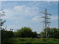
View from No Man's Meadow towards the town
Featuring the electrical supply to Bury St. Edmunds, with the old and new substation connections also shown in Image and Image Just to the left of the pylon the top of a stone tower can be seen - I think this is the Norman Tower.
Image: © John Goldsmith
Taken: 2 Sep 2011
0.05 miles
8
![Bury St Edmunds houses [192]](https://s1.geograph.org.uk/geophotos/06/68/10/6681017_fbd388c7_120x120.jpg)
Bury St Edmunds houses [192]
Number 12 Southgate Street is 14th century, timber framed with exposed widely-spaced studs and tension braces. The house contains the former two-bay open hall of a small 14th century house, much restored in the 1980s. There is a 19th century rear extension in flint and brick. Listed, grade II, with details at: https://historicengland.org.uk/listing/the-list/list-entry/1272211
Sparhawk Street runs from Honey Hill via the open space of St Mary’s Square to Southgate Street which leads to Southgate Green, the site of the town’s Southgate and where St Petronella’s Hospital was located, established in the 12th century for the treatment of female lepers. The area is rich in history and has a great variety of buildings.
Bury St Edmunds is a market town which is the cultural and retail centre for West Suffolk and is known for brewing (Greene King) and sugar (British Sugar). There is scattered evidence of earlier activity but essentially Bury St Edmunds began as one of the royal boroughs of the Saxons and a monastery was founded which became the burial place of King Edmund. A new Benedictine abbey was built in 1020 which became rich and powerful and the town was laid out on a grid pattern by Abbot Baldwin. After the dissolution the abbey became ruinous. A new church, later the cathedral, was begun in the early 16th century.
Image: © Michael Dibb
Taken: 9 Sep 2020
0.05 miles
9
![Bury St Edmunds houses [194]](https://s1.geograph.org.uk/geophotos/06/68/10/6681021_2cae8aae_120x120.jpg)
Bury St Edmunds houses [194]
Originally one house divided into two, numbers 19 and 20 Southgate Street are later 17th century incorporating fragments of an earlier structure. Timber framed, with the front wall rebuilt further forward in white brick in the early 19th century. Listed, grade II, with details at: https://historicengland.org.uk/listing/the-list/list-entry/1272103
Sparhawk Street runs from Honey Hill via the open space of St Mary’s Square to Southgate Street which leads to Southgate Green, the site of the town’s Southgate and where St Petronella’s Hospital was located, established in the 12th century for the treatment of female lepers. The area is rich in history and has a great variety of buildings.
Bury St Edmunds is a market town which is the cultural and retail centre for West Suffolk and is known for brewing (Greene King) and sugar (British Sugar). There is scattered evidence of earlier activity but essentially Bury St Edmunds began as one of the royal boroughs of the Saxons and a monastery was founded which became the burial place of King Edmund. A new Benedictine abbey was built in 1020 which became rich and powerful and the town was laid out on a grid pattern by Abbot Baldwin. After the dissolution the abbey became ruinous. A new church, later the cathedral, was begun in the early 16th century.
Image: © Michael Dibb
Taken: 9 Sep 2020
0.05 miles
10
![Bury St Edmunds houses [188]](https://s0.geograph.org.uk/geophotos/06/68/10/6681004_12a7dfd7_120x120.jpg)
Bury St Edmunds houses [188]
Number 3 Southgate Street has a 16th century core. Altered and encased in roughcast brick in the early 19th century when the two shop windows were inserted. Listed, grade II, with details at: https://historicengland.org.uk/listing/the-list/list-entry/1272198
Sparhawk Street runs from Honey Hill via the open space of St Mary’s Square to Southgate Street which leads to Southgate Green, the site of the town’s Southgate and where St Petronella’s Hospital was located, established in the 12th century for the treatment of female lepers. The area is rich in history and has a great variety of buildings.
Bury St Edmunds is a market town which is the cultural and retail centre for West Suffolk and is known for brewing (Greene King) and sugar (British Sugar). There is scattered evidence of earlier activity but essentially Bury St Edmunds began as one of the royal boroughs of the Saxons and a monastery was founded which became the burial place of King Edmund. A new Benedictine abbey was built in 1020 which became rich and powerful and the town was laid out on a grid pattern by Abbot Baldwin. After the dissolution the abbey became ruinous. A new church, later the cathedral, was begun in the early 16th century.
Image: © Michael Dibb
Taken: 9 Sep 2020
0.05 miles