
IMAGES TAKEN NEAR TO
Maynewater Square, BURY ST. EDMUNDS, IP33 2AD
Introduction
This page details the photographs taken nearby to Maynewater Square, IP33 2AD by members of the Geograph project.
The Geograph project started in 2005 with the aim of publishing, organising and preserving representative images for every square kilometre of Great Britain, Ireland and the Isle of Man.

There are currently over 7.5m images from over14,400 individuals and you can help contribute to the project by visiting https://www.geograph.org.uk
Image Map
Images are licensed for reuse under creativecommons.org/licenses/by-sa/2.0
Notes
- Clicking on the map will re-center to the selected point.
- The higher the marker number, the further away the image location is from the centre of the postcode.
Image Listing (639 Images Found)
Images are licensed for reuse under creativecommons.org/licenses/by-sa/2.0
Image
Details
Distance
1
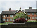
Maynewater Square, Bury St Edmunds
Housing built in 1868 for workers at the nearby Greene King Brewery.
Image: © Jonathan Thacker
Taken: 16 May 2022
0.00 miles
2
![Bury St Edmunds features [41]](https://s2.geograph.org.uk/geophotos/06/69/90/6699066_6f675da2_120x120.jpg)
Bury St Edmunds features [41]
Stretching along Maynewater Lane for some 260 yards (240 metres) is the boundary wall of the St Edmund Hospital. In kidney flint with random old red brick and divided into bays by rudimentary brick pilasters. Listed, grade II, with details at: https://historicengland.org.uk/listing/the-list/list-entry/1022593
Westgate Street is the southernmost street of the medieval grid and it is mainly about the Greene King Brewery with so many of the buildings constructed for its processes or for its employees. In addition to the brewery there is a rich mix of historic buildings in diverse materials, including white brick, red brick and stucco render. The street has the only surviving intact Regency theatre.
Bury St Edmunds is a market town which is the cultural and retail centre for West Suffolk and is known for brewing (Greene King) and sugar (British Sugar). There is scattered evidence of earlier activity but essentially Bury St Edmunds began as one of the royal boroughs of the Saxons and a monastery was founded which became the burial place of King Edmund. A new Benedictine abbey was built in 1020 which became rich and powerful and the town was laid out on a grid pattern by Abbot Baldwin. After the dissolution the abbey became ruinous. A new church, later the cathedral, was begun in the early 16th century.
Image: © Michael Dibb
Taken: 9 Sep 2020
0.03 miles
3
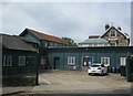
Brewery buildings on the corner of Westgate and Maynewater Lane
Image: © Jonathan Thacker
Taken: 16 May 2022
0.04 miles
4
![Bury St Edmunds houses [307]](https://s2.geograph.org.uk/geophotos/06/69/90/6699082_d9a82f69_120x120.jpg)
Bury St Edmunds houses [307]
Number 1 Westgate Street in High Victorian Gothic by Lot Jackaman, who built the Corn Exchange. Dated 1884 the house. in random knapped flint and sandstone, is designed to advertise his building skills. Listed, grade II, with details at: https://historicengland.org.uk/listing/the-list/list-entry/1141925
Westgate Street is the southernmost street of the medieval grid and it is mainly about the Greene King Brewery with so many of the buildings constructed for its processes or for its employees. In addition to the brewery there is a rich mix of historic buildings in diverse materials, including white brick, red brick and stucco render. The street has the only surviving intact Regency theatre.
Bury St Edmunds is a market town which is the cultural and retail centre for West Suffolk and is known for brewing (Greene King) and sugar (British Sugar). There is scattered evidence of earlier activity but essentially Bury St Edmunds began as one of the royal boroughs of the Saxons and a monastery was founded which became the burial place of King Edmund. A new Benedictine abbey was built in 1020 which became rich and powerful and the town was laid out on a grid pattern by Abbot Baldwin. After the dissolution the abbey became ruinous. A new church, later the cathedral, was begun in the early 16th century.
Image: © Michael Dibb
Taken: 9 Sep 2020
0.05 miles
5
![Bury St Edmunds buildings [249]](https://s3.geograph.org.uk/geophotos/06/69/90/6699063_29c302a8_120x120.jpg)
Bury St Edmunds buildings [249]
Accessed off Westgate Street is the St Edmund Hospital. Built as a house, later used as a hotel and now a private hospital and nursing home. Constructed in the early/mid 18th century, altered and extended in the 19th century. There are a mixture of 18th and early 19th centuries internal features and evidence of changes of layout. Listed, grade II, with details at: https://historicengland.org.uk/listing/the-list/list-entry/1135174
Westgate Street is the southernmost street of the medieval grid and it is mainly about the Greene King Brewery with so many of the buildings constructed for its processes or for its employees. In addition to the brewery there is a rich mix of historic buildings in diverse materials, including white brick, red brick and stucco render. The street has the only surviving intact Regency theatre.
Bury St Edmunds is a market town which is the cultural and retail centre for West Suffolk and is known for brewing (Greene King) and sugar (British Sugar). There is scattered evidence of earlier activity but essentially Bury St Edmunds began as one of the royal boroughs of the Saxons and a monastery was founded which became the burial place of King Edmund. A new Benedictine abbey was built in 1020 which became rich and powerful and the town was laid out on a grid pattern by Abbot Baldwin. After the dissolution the abbey became ruinous. A new church, later the cathedral, was begun in the early 16th century.
Image: © Michael Dibb
Taken: 9 Sep 2020
0.05 miles
6
![Bury St Edmunds houses [308]](https://s2.geograph.org.uk/geophotos/06/69/90/6699090_6eb564b5_120x120.jpg)
Bury St Edmunds houses [308]
Numbers 2, 4 and 5 Westgate Street were originally a terrace of four houses which became three when numbers 3 and 4 were combined. Built in the early 19th century in white brick. Listed, grade II, with details at: https://historicengland.org.uk/listing/the-list/list-entry/1141931
Westgate Street is the southernmost street of the medieval grid and it is mainly about the Greene King Brewery with so many of the buildings constructed for its processes or for its employees. In addition to the brewery there is a rich mix of historic buildings in diverse materials, including white brick, red brick and stucco render. The street has the only surviving intact Regency theatre.
Bury St Edmunds is a market town which is the cultural and retail centre for West Suffolk and is known for brewing (Greene King) and sugar (British Sugar). There is scattered evidence of earlier activity but essentially Bury St Edmunds began as one of the royal boroughs of the Saxons and a monastery was founded which became the burial place of King Edmund. A new Benedictine abbey was built in 1020 which became rich and powerful and the town was laid out on a grid pattern by Abbot Baldwin. After the dissolution the abbey became ruinous. A new church, later the cathedral, was begun in the early 16th century.
Image: © Michael Dibb
Taken: 9 Sep 2020
0.05 miles
7
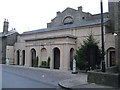
Theatre Royal Bury St Edmunds
The Theatre Royal Bury St Edmunds, Suffolk the only surviving Regency playhouse in Britain in the safe hands of the National Trust. For more info see http://en.wikipedia.org/wiki/Theatre_Royal,_Bury_St_Edmunds and for their web site see
http://secure.theatreroyal.org/PEO/site/home/index.php?
Image: © Keith Evans
Taken: 1 Jan 2009
0.05 miles
8
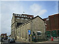
Greene King Brewery, Bury St Edmunds
Image: © Jonathan Thacker
Taken: 16 May 2022
0.05 miles
9
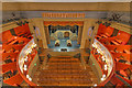
Theatre Royal, Bury St Edmunds
The interior of the theatre taken from the "Gods" during a National Trust tour.
http://www.nationaltrust.org.uk/theatre-royal/
Image: © David P Howard
Taken: 16 May 2015
0.05 miles
10
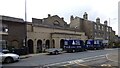
Theatre Royal, Bury St Edmunds
https://historicengland.org.uk/listing/the-list/list-entry/1142285?section=official-list-entry
Image: © Sandy Gerrard
Taken: 16 Apr 2023
0.06 miles