1
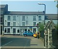
Bury St Edmunds houses [244]
Number 33 St John's Street has two gables to the street, the bay to the right a mansard. This bay has a 17th century core and is timber framed. Refronted in the 18th century when the left bay was added, in brick, again with mock timbering. There are some early 20th century extensions. Listed, grade II, with details at: https://historicengland.org.uk/listing/the-list/list-entry/1244965
North of the town centre Northgate Street and St John’s Street run towards the site of Northgate and the railway station and both streets have many older buildings. In between these two streets is a number of streets irregularly laid out (compared to the medieval grid of the town centre) containing mostly houses and buildings from the 19th century.
Bury St Edmunds is a market town which is the cultural and retail centre for West Suffolk and is known for brewing (Greene King) and sugar (British Sugar). There is scattered evidence of earlier activity but essentially Bury St Edmunds began as one of the royal boroughs of the Saxons and a monastery was founded which became the burial place of King Edmund. A new Benedictine abbey was built in 1020 which became rich and powerful and the town was laid out on a grid pattern by Abbot Baldwin. After the dissolution the abbey became ruinous. A new church, later the cathedral, was begun in the early 16th century.
Image: © Michael Dibb
Taken: 7 Sep 2020
0.01 miles
2
The Bushel
Surprisingly closed on a saturday lunchtime.
Image: © Matthew Hatton
Taken: 30 Apr 2011
0.01 miles
3
Bury St Edmunds houses [245]
This house, number 36 St John's Street was converted to a shop with offices above and has now reverted to domestic use. Built in the 17th century, timber framed and stuccoed. The shop front is late 19th century. Listed, grade II, with details at: https://historicengland.org.uk/listing/the-list/list-entry/1244966North of the town centre Northgate Street and St John’s Street run towards the site of Northgate and the railway station and both streets have many older buildings. In between these two streets is a number of streets irregularly laid out (compared to the medieval grid of the town centre) containing mostly houses and buildings from the 19th century.
Bury St Edmunds is a market town which is the cultural and retail centre for West Suffolk and is known for brewing (Greene King) and sugar (British Sugar). There is scattered evidence of earlier activity but essentially Bury St Edmunds began as one of the royal boroughs of the Saxons and a monastery was founded which became the burial place of King Edmund. A new Benedictine abbey was built in 1020 which became rich and powerful and the town was laid out on a grid pattern by Abbot Baldwin. After the dissolution the abbey became ruinous. A new church, later the cathedral, was begun in the early 16th century.
Image: © Michael Dibb
Taken: 7 Sep 2020
0.02 miles
4
St John the Evangelist, Bury St Edmunds - Stained glass window
Image: © John Salmon
Taken: 2 Sep 2017
0.02 miles
5
The Bushel public house, Bury St Edmunds
On St John's Street.
Image: © JThomas
Taken: 25 Apr 2017
0.02 miles
6
Bury St Edmunds buildings [182]
A view of St John's Street with the spire of the church of St John dominating. The Anglican parish church of St John in St John's Street was built in 1841. Constructed of white brick in the Early English style with red brick to the interior of the entrance porch. The east end was remodelled in 1875. Listed, grade II*, with details at: https://historicengland.org.uk/listing/the-list/list-entry/1135148
North of the town centre Northgate Street and St John’s Street run towards the site of Northgate and the railway station and both streets have many older buildings. In between these two streets is a number of streets irregularly laid out (compared to the medieval grid of the town centre) containing mostly houses and buildings from the 19th century.
Bury St Edmunds is a market town which is the cultural and retail centre for West Suffolk and is known for brewing (Greene King) and sugar (British Sugar). There is scattered evidence of earlier activity but essentially Bury St Edmunds began as one of the royal boroughs of the Saxons and a monastery was founded which became the burial place of King Edmund. A new Benedictine abbey was built in 1020 which became rich and powerful and the town was laid out on a grid pattern by Abbot Baldwin. After the dissolution the abbey became ruinous. A new church, later the cathedral, was begun in the early 16th century.
Image: © Michael Dibb
Taken: 7 Sep 2020
0.02 miles
7
Sign for the Bushel, Bury St Edmunds
Image: © JThomas
Taken: 14 Sep 2015
0.03 miles
8
The Spire of the Church of St John the Evangelist at Bury St Edmunds
Viewed from the south.
Image: © Peter Wood
Taken: 14 Nov 2014
0.03 miles
9
Ordnance Survey Cut Mark
This can be found on the wall of St John's Church in Bury St Edmunds.
For more detail see : http://www.bench-marks.org.uk/bm31374
Image: © Peter Wood
Taken: 14 Nov 2014
0.03 miles
10
Orchard Street
Orchard Street Bury St.Edmunds, Suffolk.
Image: © Keith Evans
Taken: 5 Feb 2012
0.03 miles


![Bury St Edmunds houses [244]](https://s1.geograph.org.uk/geophotos/06/68/78/6687813_69aa8d24_120x120.jpg)

![Bury St Edmunds houses [245]](https://s0.geograph.org.uk/geophotos/06/68/78/6687820_591333e7_120x120.jpg)


![Bury St Edmunds buildings [182]](https://s1.geograph.org.uk/geophotos/06/68/86/6688693_22b74936_120x120.jpg)


