
IMAGES TAKEN NEAR TO
St. Johns Place, BURY ST. EDMUNDS, IP33 1SW
Introduction
This page details the photographs taken nearby to St. Johns Place, IP33 1SW by members of the Geograph project.
The Geograph project started in 2005 with the aim of publishing, organising and preserving representative images for every square kilometre of Great Britain, Ireland and the Isle of Man.

There are currently over 7.5m images from over14,400 individuals and you can help contribute to the project by visiting https://www.geograph.org.uk
Image Map
Images are licensed for reuse under creativecommons.org/licenses/by-sa/2.0
Notes
- Clicking on the map will re-center to the selected point.
- The higher the marker number, the further away the image location is from the centre of the postcode.
Image Listing (468 Images Found)
Images are licensed for reuse under creativecommons.org/licenses/by-sa/2.0
Image
Details
Distance
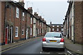
2
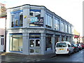
A grey paint job
A rather grey painted shop on the corner of St.Johns street and St.Johns Place Bury St.Edmunds Suffolk.
Image: © Keith Evans
Taken: 23 Dec 2007
0.01 miles
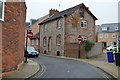
4
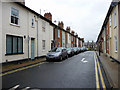
St John's Place, Bury St Edmunds, Suffolk
As seen from St John Street.
Image: © Christine Matthews
Taken: 8 May 2010
0.03 miles
6
![Bury St Edmunds houses [247]](https://s0.geograph.org.uk/geophotos/06/68/86/6688680_8cf18d8a_120x120.jpg)
Bury St Edmunds houses [247]
Numbers 53 and 53A st John's Street were one house divided into two. Early 19th century with an older core. The 19th century shop windows have been replaced with sashes. Listed, grade II, with details at: https://historicengland.org.uk/listing/the-list/list-entry/1313423
North of the town centre Northgate Street and St John’s Street run towards the site of Northgate and the railway station and both streets have many older buildings. In between these two streets is a number of streets irregularly laid out (compared to the medieval grid of the town centre) containing mostly houses and buildings from the 19th century.
Bury St Edmunds is a market town which is the cultural and retail centre for West Suffolk and is known for brewing (Greene King) and sugar (British Sugar). There is scattered evidence of earlier activity but essentially Bury St Edmunds began as one of the royal boroughs of the Saxons and a monastery was founded which became the burial place of King Edmund. A new Benedictine abbey was built in 1020 which became rich and powerful and the town was laid out on a grid pattern by Abbot Baldwin. After the dissolution the abbey became ruinous. A new church, later the cathedral, was begun in the early 16th century.
Image: © Michael Dibb
Taken: 7 Sep 2020
0.03 miles
7
![Bury St Edmunds buildings [182]](https://s1.geograph.org.uk/geophotos/06/68/86/6688693_22b74936_120x120.jpg)
Bury St Edmunds buildings [182]
A view of St John's Street with the spire of the church of St John dominating. The Anglican parish church of St John in St John's Street was built in 1841. Constructed of white brick in the Early English style with red brick to the interior of the entrance porch. The east end was remodelled in 1875. Listed, grade II*, with details at: https://historicengland.org.uk/listing/the-list/list-entry/1135148
North of the town centre Northgate Street and St John’s Street run towards the site of Northgate and the railway station and both streets have many older buildings. In between these two streets is a number of streets irregularly laid out (compared to the medieval grid of the town centre) containing mostly houses and buildings from the 19th century.
Bury St Edmunds is a market town which is the cultural and retail centre for West Suffolk and is known for brewing (Greene King) and sugar (British Sugar). There is scattered evidence of earlier activity but essentially Bury St Edmunds began as one of the royal boroughs of the Saxons and a monastery was founded which became the burial place of King Edmund. A new Benedictine abbey was built in 1020 which became rich and powerful and the town was laid out on a grid pattern by Abbot Baldwin. After the dissolution the abbey became ruinous. A new church, later the cathedral, was begun in the early 16th century.
Image: © Michael Dibb
Taken: 7 Sep 2020
0.03 miles
8
Peckham Street, Bury St.Edmunds
A narrow street of terraced housing converted to one-way to allow parking along one side of the street. A new property has been added to the terrace on the left.
Image: © Martin Addison
Taken: 22 Sep 2012
0.03 miles
9
![Bury St Edmunds houses [246]](https://s1.geograph.org.uk/geophotos/06/68/86/6688677_f59e434f_120x120.jpg)
Bury St Edmunds houses [246]
Numbers 51 and 52 St John's Street were originally one 16th century timber framed house. Divided into two properties in the early 19th century with shop fronts inserted. Number 51 has a replacement 20th century shop window, number 52 has retained its 19th century shop window. There is a timber framed rear wing to number 52, now of 3 bays but originally with at least one more. Listed, grade II, with details at: https://historicengland.org.uk/listing/the-list/list-entry/1313422
North of the town centre Northgate Street and St John’s Street run towards the site of Northgate and the railway station and both streets have many older buildings. In between these two streets is a number of streets irregularly laid out (compared to the medieval grid of the town centre) containing mostly houses and buildings from the 19th century.
Bury St Edmunds is a market town which is the cultural and retail centre for West Suffolk and is known for brewing (Greene King) and sugar (British Sugar). There is scattered evidence of earlier activity but essentially Bury St Edmunds began as one of the royal boroughs of the Saxons and a monastery was founded which became the burial place of King Edmund. A new Benedictine abbey was built in 1020 which became rich and powerful and the town was laid out on a grid pattern by Abbot Baldwin. After the dissolution the abbey became ruinous. A new church, later the cathedral, was begun in the early 16th century.
Image: © Michael Dibb
Taken: 7 Sep 2020
0.03 miles
10
![Bury St Edmunds houses [248]](https://s1.geograph.org.uk/geophotos/06/68/86/6688689_1132a8ca_120x120.jpg)
Bury St Edmunds houses [248]
Number 54 St John's Street is 18th century with 19th and 20th century rear extensions. An L shaped plan with a long rear wing, in red brick with a mansard roof. This was the vicarage to the adjacent church of St John, later a bed and breakfast establishment. From 1975 to 2007 the building was used as offices and has now reverted to a domestic residence. Listed, grade II, with details at: https://historicengland.org.uk/listing/the-list/list-entry/1313424
The garden wall, some 11 metres long is early 19th century in red brick and is listed, grade II, with details at: https://historicengland.org.uk/listing/the-list/list-entry/1313426
North of the town centre Northgate Street and St John’s Street run towards the site of Northgate and the railway station and both streets have many older buildings. In between these two streets is a number of streets irregularly laid out (compared to the medieval grid of the town centre) containing mostly houses and buildings from the 19th century.
Bury St Edmunds is a market town which is the cultural and retail centre for West Suffolk and is known for brewing (Greene King) and sugar (British Sugar). There is scattered evidence of earlier activity but essentially Bury St Edmunds began as one of the royal boroughs of the Saxons and a monastery was founded which became the burial place of King Edmund. A new Benedictine abbey was built in 1020 which became rich and powerful and the town was laid out on a grid pattern by Abbot Baldwin. After the dissolution the abbey became ruinous. A new church, later the cathedral, was begun in the early 16th century.
Image: © Michael Dibb
Taken: 7 Sep 2020
0.03 miles