
IMAGES TAKEN NEAR TO
Friars Lane, BURY ST. EDMUNDS, IP33 1QQ
Introduction
This page details the photographs taken nearby to Friars Lane, IP33 1QQ by members of the Geograph project.
The Geograph project started in 2005 with the aim of publishing, organising and preserving representative images for every square kilometre of Great Britain, Ireland and the Isle of Man.

There are currently over 7.5m images from over14,400 individuals and you can help contribute to the project by visiting https://www.geograph.org.uk
Image Map
Images are licensed for reuse under creativecommons.org/licenses/by-sa/2.0
Notes
- Clicking on the map will re-center to the selected point.
- The higher the marker number, the further away the image location is from the centre of the postcode.
Image Listing (864 Images Found)
Images are licensed for reuse under creativecommons.org/licenses/by-sa/2.0
Image
Details
Distance
2
![Bury St Edmunds houses [312]](https://s0.geograph.org.uk/geophotos/06/69/98/6699836_75a7e271_120x120.jpg)
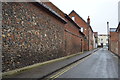
Bury St Edmunds houses [312]
Number 2 Friar's Lane is a pair of cottages made into one house. Built circa 1760, timber framed and roughcast, the internal layouts of the cottages are unchanged with a single door connecting the two halves. Friar's Lane runs from Westgate Street to the River Linnet and becomes a footpath. Listed, grade II, with details at: https://historicengland.org.uk/listing/the-list/list-entry/1363686
Westgate Street is the southernmost street of the medieval grid and it is mainly about the Greene King Brewery with so many of the buildings constructed for its processes or for its employees. In addition to the brewery there is a rich mix of historic buildings in diverse materials, including white brick, red brick and stucco render. The street has the only surviving intact Regency theatre.
Bury St Edmunds is a market town which is the cultural and retail centre for West Suffolk and is known for brewing (Greene King) and sugar (British Sugar). There is scattered evidence of earlier activity but essentially Bury St Edmunds began as one of the royal boroughs of the Saxons and a monastery was founded which became the burial place of King Edmund. A new Benedictine abbey was built in 1020 which became rich and powerful and the town was laid out on a grid pattern by Abbot Baldwin. After the dissolution the abbey became ruinous. A new church, later the cathedral, was begun in the early 16th century.
Image: © Michael Dibb
Taken: 12 Sep 2020
0.02 miles
3
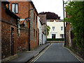
Friar's Lane
Looking towards the junction with Westgate Street.
Image: © Andrew Hill
Taken: 7 May 2009
0.03 miles
6
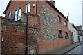
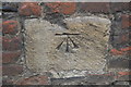
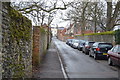
2, Friar's Lane
Grade II listed. https://www.britishlistedbuildings.co.uk/101363686-2-friars-lane-bury-st-edmunds
Image: © N Chadwick
Taken: 10 Feb 2018
0.03 miles
7
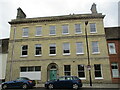
Westgate House, Bury St Edmunds
Built in 1865.
Image: © Jonathan Thacker
Taken: 16 May 2022
0.04 miles
8
![Bury St Edmunds houses [313]](https://s1.geograph.org.uk/geophotos/06/69/98/6699837_0a88fa7d_120x120.jpg)
Bury St Edmunds houses [313]
Numbers 14 and 15 Westgate Street are a pair of houses built in the early 19th century in flint and white brick. There is a later 19th century rear extension. Listed, grade II, with details at: https://historicengland.org.uk/listing/the-list/list-entry/1142301
Westgate Street is the southernmost street of the medieval grid and it is mainly about the Greene King Brewery with so many of the buildings constructed for its processes or for its employees. In addition to the brewery there is a rich mix of historic buildings in diverse materials, including white brick, red brick and stucco render. The street has the only surviving intact Regency theatre.
Bury St Edmunds is a market town which is the cultural and retail centre for West Suffolk and is known for brewing (Greene King) and sugar (British Sugar). There is scattered evidence of earlier activity but essentially Bury St Edmunds began as one of the royal boroughs of the Saxons and a monastery was founded which became the burial place of King Edmund. A new Benedictine abbey was built in 1020 which became rich and powerful and the town was laid out on a grid pattern by Abbot Baldwin. After the dissolution the abbey became ruinous. A new church, later the cathedral, was begun in the early 16th century.
Image: © Michael Dibb
Taken: 12 Sep 2020
0.04 miles
9
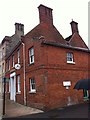
Thomas Peatling, Westgate Street
Wine Merchant.
Image: © Andrew Abbott
Taken: 15 Sep 2013
0.04 miles
10
![Bury St Edmunds houses [311]](https://s3.geograph.org.uk/geophotos/06/69/98/6699835_3ac55bae_120x120.jpg)
Bury St Edmunds houses [311]
Number 12 Westgate Street was built in the later 17th century, timber framed and stuccoed, refronted in the 18th century. Restored in the 1970s and some original internal features remain. Listed, grade II, with details at: https://historicengland.org.uk/listing/the-list/list-entry/1142299
Westgate Street is the southernmost street of the medieval grid and it is mainly about the Greene King Brewery with so many of the buildings constructed for its processes or for its employees. In addition to the brewery there is a rich mix of historic buildings in diverse materials, including white brick, red brick and stucco render. The street has the only surviving intact Regency theatre.
Bury St Edmunds is a market town which is the cultural and retail centre for West Suffolk and is known for brewing (Greene King) and sugar (British Sugar). There is scattered evidence of earlier activity but essentially Bury St Edmunds began as one of the royal boroughs of the Saxons and a monastery was founded which became the burial place of King Edmund. A new Benedictine abbey was built in 1020 which became rich and powerful and the town was laid out on a grid pattern by Abbot Baldwin. After the dissolution the abbey became ruinous. A new church, later the cathedral, was begun in the early 16th century.
Image: © Michael Dibb
Taken: 12 Sep 2020
0.04 miles