1
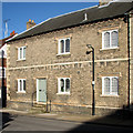
2 and 3 College Street, Bury St Edmunds
Subdivided sixteenth century house https://historicengland.org.uk/listing/the-list/list-entry/1248305?section=official-list-entry
Image: © Jonathan Thacker
Taken: 16 May 2022
0.01 miles
2
Bury St Edmunds houses [153]
Probably built in the early 19th century, number 60 College Street was once part of the old Town Workhouse complex. The large window on the left suggests that it may once have been used as a shop.
College Street is one of the north-south streets within the medieval grid and is a continuation southward of Hatter Street, running from Churchgate Street to Westgate Street. Almost entirely residential but there is a Victorian school at the south end.
Bury St Edmunds is a market town which is the cultural and retail centre for West Suffolk and is known for brewing (Greene King) and sugar (British Sugar). There is scattered evidence of earlier activity but essentially Bury St Edmunds began as one of the royal boroughs of the Saxons and a monastery was founded which became the burial place of King Edmund. A new Benedictine abbey was built in 1020 which became rich and powerful and the town was laid out on a grid pattern by Abbot Baldwin. After the dissolution the abbey became ruinous. A new church, later the cathedral, was begun in the early 16th century.
Image: © Michael Dibb
Taken: 12 Sep 2020
0.01 miles
3
Bury St Edmunds houses [138]
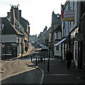
Numbers 4 and 5 College Street are a pair of semid-detached houses. Built in the early 19th century in white brick. Listed, grade II, with details at: https://historicengland.org.uk/listing/the-list/list-entry/1248306
College Street is one of the north-south streets within the medieval grid and is a continuation southward of Hatter Street, running from Churchgate Street to Westgate Street. Almost entirely residential but there is a Victorian school at the south end.
Bury St Edmunds is a market town which is the cultural and retail centre for West Suffolk and is known for brewing (Greene King) and sugar (British Sugar). There is scattered evidence of earlier activity but essentially Bury St Edmunds began as one of the royal boroughs of the Saxons and a monastery was founded which became the burial place of King Edmund. A new Benedictine abbey was built in 1020 which became rich and powerful and the town was laid out on a grid pattern by Abbot Baldwin. After the dissolution the abbey became ruinous. A new church, later the cathedral, was begun in the early 16th century.
Image: © Michael Dibb
Taken: 12 Sep 2020
0.01 miles
4
Bury St Edmunds houses [139]
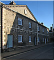
Number 7 College Street has parts from the 15th, 16th and 17th centuries with a main range and a tall gabled cross wing. The main range is a complete 17th century rebuilt of an earlier structure. The whole is timber framed and stuccoed. Listed, grade II, with details at: https://historicengland.org.uk/listing/the-list/list-entry/1248307
College Street is one of the north-south streets within the medieval grid and is a continuation southward of Hatter Street, running from Churchgate Street to Westgate Street. Almost entirely residential but there is a Victorian school at the south end.
Bury St Edmunds is a market town which is the cultural and retail centre for West Suffolk and is known for brewing (Greene King) and sugar (British Sugar). There is scattered evidence of earlier activity but essentially Bury St Edmunds began as one of the royal boroughs of the Saxons and a monastery was founded which became the burial place of King Edmund. A new Benedictine abbey was built in 1020 which became rich and powerful and the town was laid out on a grid pattern by Abbot Baldwin. After the dissolution the abbey became ruinous. A new church, later the cathedral, was begun in the early 16th century.
Image: © Michael Dibb
Taken: 12 Sep 2020
0.01 miles
5
7 College Street, Bury St Edmunds
House of the fifteenth to seventeenth centuries https://historicengland.org.uk/listing/the-list/list-entry/1248307?section=official-list-entry
Image: © Jonathan Thacker
Taken: 16 May 2022
0.01 miles
6
Bury St Edmunds houses [137]
Numbers 2 and 3 College Street are one house divided into two in the early 19th century. Built in the 16th century, possibly incorporating an earlier structure, timber framed, jettied along the street and roughcast. Some 19th century internal features remain. Listed, grade II, with details at: https://historicengland.org.uk/listing/the-list/list-entry/1248305
College Street is one of the north-south streets within the medieval grid and is a continuation southward of Hatter Street, running from Churchgate Street to Westgate Street. Almost entirely residential but there is a Victorian school at the south end.
Bury St Edmunds is a market town which is the cultural and retail centre for West Suffolk and is known for brewing (Greene King) and sugar (British Sugar). There is scattered evidence of earlier activity but essentially Bury St Edmunds began as one of the royal boroughs of the Saxons and a monastery was founded which became the burial place of King Edmund. A new Benedictine abbey was built in 1020 which became rich and powerful and the town was laid out on a grid pattern by Abbot Baldwin. After the dissolution the abbey became ruinous. A new church, later the cathedral, was begun in the early 16th century.
Image: © Michael Dibb
Taken: 12 Sep 2020
0.01 miles
7
Bury St Edmunds: house with a history
The William Barnaby Almshouses were endowed in 1571 and rebuilt in 1826. Now four houses, from 1954-78 the building was occupied by a builders' merchant, whose faded painted lettering still appears on the frontage: Timber Merchants Marlow & Co Ltd Builders Supplies. For other views of the building, see
Image] and
Image
For the British Listed Buildings citation, see http://www.britishlistedbuildings.co.uk/en-466736-8-11-college-street-b.ury-st-edmunds-suff .
Image: © John Sutton
Taken: 17 Feb 2015
0.01 miles
8
College Street, Bury St Edmunds, Suffolk
Image: © Andrew Norburn
Taken: 3 Jul 2006
0.02 miles
9
Bury St Edmunds: Hatter Street to College Street
A view across Churchgate Street, against the light on a sunny January morning.
Image: © John Sutton
Taken: 23 Jan 2015
0.02 miles
10
Bury St Edmunds: faded lettering on former almshouses
The almshouses were endowed in 1571 and rebuilt in 1826. Now four houses, from 1954-78 the building was occupied by a builders' merchant, whose faded painted lettering still appears on the frontage: Timber Merchants Marlow & Co Ltd Builders Supplies. For other views of the building, see
Image] and
Image
For the British Listed Buildings citation, see http://www.britishlistedbuildings.co.uk/en-466736-8-11-college-street-b.ury-st-edmunds-suff
Image: © John Sutton
Taken: 17 Feb 2015
0.02 miles


![Bury St Edmunds houses [153]](https://s1.geograph.org.uk/geophotos/06/67/69/6676985_fa7082fd_120x120.jpg)
![Bury St Edmunds houses [138]](https://s0.geograph.org.uk/geophotos/06/67/53/6675344_403a29e0_120x120.jpg)
![Bury St Edmunds houses [139]](https://s0.geograph.org.uk/geophotos/06/67/56/6675672_56ff1474_120x120.jpg)

![Bury St Edmunds houses [137]](https://s0.geograph.org.uk/geophotos/06/67/53/6675332_cd730acc_120x120.jpg)


