
IMAGES TAKEN NEAR TO
Athenaeum Lane, BURY ST. EDMUNDS, IP33 1LY
Introduction
This page details the photographs taken nearby to Athenaeum Lane, IP33 1LY by members of the Geograph project.
The Geograph project started in 2005 with the aim of publishing, organising and preserving representative images for every square kilometre of Great Britain, Ireland and the Isle of Man.

There are currently over 7.5m images from over14,400 individuals and you can help contribute to the project by visiting https://www.geograph.org.uk
Image Map
Images are licensed for reuse under creativecommons.org/licenses/by-sa/2.0
Notes
- Clicking on the map will re-center to the selected point.
- The higher the marker number, the further away the image location is from the centre of the postcode.
Image Listing (2033 Images Found)
Images are licensed for reuse under creativecommons.org/licenses/by-sa/2.0
Image
Details
Distance
1
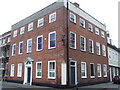
Square building
Old building on the corner of Church gate street and Angel hill Bury St.Edmunds Suffolk.
Image: © Keith Evans
Taken: 1 Jan 2008
0.00 miles
2
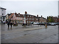
Bury St Edmunds, Suffolk
Looking across from the entrance to Abbey Gardens towards Abbeygate Street.
Image: © Christine Matthews
Taken: 8 May 2010
0.01 miles
3
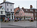
Abbeygate Street, Bury St Edmunds, Suffolk
Looking across the square towards Abbeygate Street.
Image: © Christine Matthews
Taken: 8 May 2010
0.01 miles
4
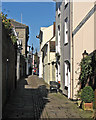
Bury St Edmunds: Athenaeum Lane
Looking towards Angel Hill and The Athenaeum from Churchgate Street.
Image: © John Sutton
Taken: 17 Feb 2015
0.01 miles
5
![Bury St Edmunds houses [12]](https://s0.geograph.org.uk/geophotos/06/65/09/6650916_b6d51e51_120x120.jpg)
Bury St Edmunds houses [12]
Numbers 5 and 6 Athenaeum Lane are a pair of late 18th or early 19th century houses in stuccoed brick.
Bury St Edmunds is a market town which is the cultural and retail centre for West Suffolk and is known for brewing (Greene King) and sugar (British Sugar). There is scattered evidence of earlier activity but essentially Bury St Edmunds began as one of the royal boroughs of the Saxons and a monastery was founded which became the burial place of King Edmund. A new Benedictine abbey was built in 1020 which became rich and powerful and the town was laid out on a grid pattern by Abbot Baldwin. After the dissolution the abbey became ruinous. A new church, later the cathedral, was begun in the early 16th century.
Image: © Michael Dibb
Taken: 14 Sep 2020
0.01 miles
6
![Bury St Edmunds houses [13]](https://s3.geograph.org.uk/geophotos/06/65/09/6650931_83489fba_120x120.jpg)
Bury St Edmunds houses [13]
Described as Abbot Anselm's Institute, the house has been divided into 4 flats, numbers 1 to 4 Anselm Court. The main frontage, seen here, is onto Angel Hill but the access is from Athenaeum Lane. The 17th century timber framed and rendered house has been altered in the 18th and later centuries. The ground floor brick is probably an underbuilding of a former jetty. Listed, for group value, grade II, with details at: https://historicengland.org.uk/listing/the-list/list-entry/1377005
Bury St Edmunds is a market town which is the cultural and retail centre for West Suffolk and is known for brewing (Greene King) and sugar (British Sugar). There is scattered evidence of earlier activity but essentially Bury St Edmunds began as one of the royal boroughs of the Saxons and a monastery was founded which became the burial place of King Edmund. A new Benedictine abbey was built in 1020 which became rich and powerful and the town was laid out on a grid pattern by Abbot Baldwin. After the dissolution the abbey became ruinous. A new church, later the cathedral, was begun in the early 16th century.
Image: © Michael Dibb
Taken: 11 Sep 2020
0.01 miles
7
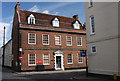
Churchgate House, Bury St Edmunds
The new home of Lord and Lady Tebbit http://www.buryfreepress.co.uk/news/Lord-Tebbitt-moves-in.4951561.jp
Image: © Bob Jones
Taken: 31 Jul 2009
0.01 miles
8
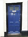
Angled door
Old door Athenaeum Lane Bury St.Edmunds Suffolk.
Image: © Keith Evans
Taken: 1 Jan 2008
0.01 miles
9
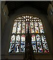
Bury St Edmunds - Cathedral - Great West Window
The Great West Window of Image] is in the Perpendicular Gothic style in conformity with the rest of the cathedral. I would guess that the glass is Victorian or Edwardian.
Image: © Rob Farrow
Taken: 26 Feb 2022
0.01 miles
10
![Bury St Edmunds houses [49]](https://s0.geograph.org.uk/geophotos/06/65/68/6656828_de33e3eb_120x120.jpg)
Bury St Edmunds houses [49]
Number 36 Churchgate Street was built circa 1815 in red brick. There is a short side frontage to Athenaeum Lane. Listed, grade II, with details at: https://historicengland.org.uk/listing/the-list/list-entry/1248208
Churchgate Street is aligned with the Norman Tower entrance to the Abbey and would have been the ceremonial route between the Abbey and the Guildhall, the spiritual and the temporal. The street has some of the town’s most important historic buildings with structures dating back to the 13th century.
Bury St Edmunds is a market town which is the cultural and retail centre for West Suffolk and is known for brewing (Greene King) and sugar (British Sugar). There is scattered evidence of earlier activity but essentially Bury St Edmunds began as one of the royal boroughs of the Saxons and a monastery was founded which became the burial place of King Edmund. A new Benedictine abbey was built in 1020 which became rich and powerful and the town was laid out on a grid pattern by Abbot Baldwin. After the dissolution the abbey became ruinous. A new church, later the cathedral, was begun in the early 16th century.
Image: © Michael Dibb
Taken: 12 Sep 2020
0.01 miles