IMAGES TAKEN NEAR TO
Lower Baxter Street, BURY ST. EDMUNDS, IP33 1LX
Introduction
This page details the photographs taken nearby to Lower Baxter Street, IP33 1LX by members of the Geograph project.
The Geograph project started in 2005 with the aim of publishing, organising and preserving representative images for every square kilometre of Great Britain, Ireland and the Isle of Man.

There are currently over 7.5m images from over14,400 individuals and you can help contribute to the project by visiting https://www.geograph.org.uk
Image Map
Images are licensed for reuse under creativecommons.org/licenses/by-sa/2.0
Notes
- Clicking on the map will re-center to the selected point.
- The higher the marker number, the further away the image location is from the centre of the postcode.
Image Listing (1799 Images Found)
Images are licensed for reuse under creativecommons.org/licenses/by-sa/2.0
Image
Details
Distance
1

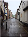
Christmas lights, town centre
Blue LEDs seem to be compulsory in 2008 Christmas decorations. Here Marks and Spencer is one of the businesses to use dull rectangular nets of them. But Starbucks and Thomas Cook do not seem to have made any effort at all.
Image: © John Goldsmith
Taken: 29 Dec 2008
0.01 miles
2
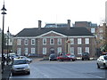
Borough offices
The borough offices of St.Edmundsbury borough council Angel Hill Bury St.Edmunds Suffolk.
Image: © Keith Evans
Taken: 23 Dec 2007
0.03 miles
3
![Bury St Edmunds buildings [41]](https://s2.geograph.org.uk/geophotos/06/64/85/6648534_b28a21e2_120x120.jpg)
Bury St Edmunds buildings [41]
This large house, number 8 Angel Hill, known as Angel Corner, is now used as commercial offices. Built in 1702 in red brick, the house was refronted in the mid 19th century. The house is owned by the National Trust. Some original internal features remain. Listed, grade II, with details at: https://historicengland.org.uk/listing/the-list/list-entry/1141157
Now used as a car park, Angel Hill the traditional market place was, until the 1870s, home to the famous Bury Fair. People from Europe and across the Far East came to buy and sell.
Bury St Edmunds is a market town which is the cultural and retail centre for West Suffolk and is known for brewing (Greene King) and sugar (British Sugar). There is scattered evidence of earlier activity but essentially Bury St Edmunds began as one of the royal boroughs of the Saxons and a monastery was founded which became the burial place of King Edmund. A new Benedictine abbey was built in 1020 which became rich and powerful and the town was laid out on a grid pattern by Abbot Baldwin. After the dissolution the abbey became ruinous. A new church, later the cathedral, was begun in the early 16th century.
Image: © Michael Dibb
Taken: 11 Sep 2020
0.03 miles
4
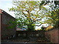
Unusual cemetery in a car park
The tombstones have obviously been moved into this position at the back of a car park in the historic core of Bury St. Edmunds, surrounding an old tree.
Image: © John Goldsmith
Taken: 15 May 2009
0.03 miles
6
![Bury St Edmunds buildings [40]](https://s0.geograph.org.uk/geophotos/06/64/81/6648144_44e6dd3a_120x120.jpg)
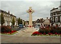
Bury St Edmunds buildings [40]
Number 7 Angel Hill, was built in the 1930s to house the Borough Council's offices which it did until the council moved in 2009. Now part of the building is used as commercial offices, part has been converted to residential. The style is early 18th century Palladian.
Now used as a car park, Angel Hill the traditional market place was, until the 1870s, home to the famous Bury Fair. People from Europe and across the Far East came to buy and sell.
Bury St Edmunds is a market town which is the cultural and retail centre for West Suffolk and is known for brewing (Greene King) and sugar (British Sugar). There is scattered evidence of earlier activity but essentially Bury St Edmunds began as one of the royal boroughs of the Saxons and a monastery was founded which became the burial place of King Edmund. A new Benedictine abbey was built in 1020 which became rich and powerful and the town was laid out on a grid pattern by Abbot Baldwin. After the dissolution the abbey became ruinous. A new church, later the cathedral, was begun in the early 16th century.
Image: © Michael Dibb
Taken: 11 Sep 2020
0.04 miles
7
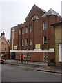
Trinity Methodist Church
Located on Brentgovel Street http://www.trinitymethodistchurch.org.uk/
Image: © Oxyman
Taken: 11 Apr 2009
0.04 miles
8
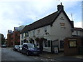
The King's Arms, Bury St Edmunds
On Brentgovel Street.
Image: © JThomas
Taken: 14 Sep 2015
0.04 miles
9
![Bury St Edmunds buildings [229]](https://s1.geograph.org.uk/geophotos/06/69/74/6697417_2ea38103_120x120.jpg)
Bury St Edmunds buildings [229]
The Kings Arms public house at number 23 Brentgovel Street is 17th century incorporating an earlier structure, timber framed, encased in brick in the 19th century. There is a long rear range built in two phases. Listed, grade II, with details at: https://historicengland.org.uk/listing/the-list/list-entry/1377010
Brentgovel Street and Risbygate Street was a prosperous area in the fifteenth century but it became neglected and decay had set in. In the 1990s, a Conservation Area Partnership Schemes was introduced to give a new lease of life into the area by repairing and reusing historic buildings. Forty five new residential units and ten new retail units have resulted in the area thriving again.
Bury St Edmunds is a market town which is the cultural and retail centre for West Suffolk and is known for brewing (Greene King) and sugar (British Sugar). There is scattered evidence of earlier activity but essentially Bury St Edmunds began as one of the royal boroughs of the Saxons and a monastery was founded which became the burial place of King Edmund. A new Benedictine abbey was built in 1020 which became rich and powerful and the town was laid out on a grid pattern by Abbot Baldwin. After the dissolution the abbey became ruinous. A new church, later the cathedral, was begun in the early 16th century.
Image: © Michael Dibb
Taken: 8 Sep 2020
0.04 miles