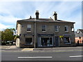
IMAGES TAKEN NEAR TO
Etna Road, BURY ST. EDMUNDS, IP33 1JF
Introduction
This page details the photographs taken nearby to Etna Road, IP33 1JF by members of the Geograph project.
The Geograph project started in 2005 with the aim of publishing, organising and preserving representative images for every square kilometre of Great Britain, Ireland and the Isle of Man.

There are currently over 7.5m images from over14,400 individuals and you can help contribute to the project by visiting https://www.geograph.org.uk
Image Map
Images are licensed for reuse under creativecommons.org/licenses/by-sa/2.0
Notes
- Clicking on the map will re-center to the selected point.
- The higher the marker number, the further away the image location is from the centre of the postcode.
Image Listing (293 Images Found)
Images are licensed for reuse under creativecommons.org/licenses/by-sa/2.0
Image
Details
Distance
1
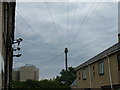
Telecoms dominate the sky in Etna Road
OK, the sugar factory silos are pretty obvious too.
Image: © John Goldsmith
Taken: 1 Aug 2010
0.02 miles
2
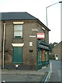
Old shop
Old shop Bury St.Edmunds Suffolk. For close up of the corner stone see http://www.geograph.org.uk/photo/825072
Image: © Keith Evans
Taken: 31 May 2008
0.03 miles
3
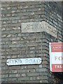
Etna cottage
Corner stone and road name on the corner of an old shop Bury St. Edmunds, Suffolk. For view of the shop see http://www.geograph.org.uk/photo/825069
Image: © Keith Evans
Taken: 31 May 2008
0.03 miles
5
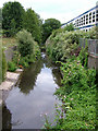
River Lark at the rear of Etna Road industrial park
For several hundred yards the River Lark runs parallel to the railway - I do not think there is much doubt the Victorians diverted the river into this channel when they built the railway embankment. The railway is just to the left here, and the river turns sharply at the photographer's feet to pass under the bridge shown in Image
Hidden in the greenery is a much more modern bridge where the A14 access road passes over the river. On the right the industrial park is dominated by Tartan House, the prefabricated building now owned by Taylor Wimpey.
Image: © John Goldsmith
Taken: 1 Aug 2010
0.05 miles
6
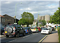
Northgate Roundabout, Sugar Silos, And So to Bed
Tayfen Road where it meets Northgate Street roundabout. The sugar factory silos dominate the skyline. The apparent big wooden shed occupied by 'And so to bed' was a normal brick building until a few years ago when someone had the odd idea of adding wooden cladding.
Image: © John Goldsmith
Taken: 1 Sep 2008
0.05 miles
9
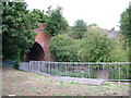
Bridge foundations by River Lark, Bury St. Edmunds
The River Lark does a sharp turn here to pass under the railway bridge. In the foreground we see what was clearly once a bridge support - there is an identical block just visible on the other side. Since the building of the A14 access road this access route is not needed, and anyway this narrow strip of land is not used.
Views of the river in each direction can be seen in Image and Image
Image: © John Goldsmith
Taken: 1 Aug 2010
0.05 miles