
IMAGES TAKEN NEAR TO
Northgate Street, BURY ST. EDMUNDS, IP33 1HG
Introduction
This page details the photographs taken nearby to Northgate Street, IP33 1HG by members of the Geograph project.
The Geograph project started in 2005 with the aim of publishing, organising and preserving representative images for every square kilometre of Great Britain, Ireland and the Isle of Man.

There are currently over 7.5m images from over14,400 individuals and you can help contribute to the project by visiting https://www.geograph.org.uk
Image Map
Images are licensed for reuse under creativecommons.org/licenses/by-sa/2.0
Notes
- Clicking on the map will re-center to the selected point.
- The higher the marker number, the further away the image location is from the centre of the postcode.
Image Listing (1576 Images Found)
Images are licensed for reuse under creativecommons.org/licenses/by-sa/2.0
Image
Details
Distance
1
![Bury St Edmunds houses [272]](https://s3.geograph.org.uk/geophotos/06/69/31/6693199_b2e33051_120x120.jpg)
Bury St Edmunds houses [272]
Number 119 Northgate Street is an early 19th century house in white brick. Used as offices for many years it is now three flats. Listed, grade II, with details at: https://historicengland.org.uk/listing/the-list/list-entry/1365778
North of the town centre Northgate Street and St John’s Street run towards the site of Northgate and the railway station and both streets have many older buildings. In between these two streets is a number of streets irregularly laid out (compared to the medieval grid of the town centre) containing mostly houses and buildings from the 19th century.
Bury St Edmunds is a market town which is the cultural and retail centre for West Suffolk and is known for brewing (Greene King) and sugar (British Sugar). There is scattered evidence of earlier activity but essentially Bury St Edmunds began as one of the royal boroughs of the Saxons and a monastery was founded which became the burial place of King Edmund. A new Benedictine abbey was built in 1020 which became rich and powerful and the town was laid out on a grid pattern by Abbot Baldwin. After the dissolution the abbey became ruinous. A new church, later the cathedral, was begun in the early 16th century.
Image: © Michael Dibb
Taken: 10 Sep 2020
0.01 miles
2
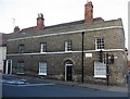
Town houses on Northgate Street
Nice building but a very busy junction.
Image: © Mr Ignavy
Taken: 27 Oct 2008
0.01 miles
3
![Bury St Edmunds houses [273]](https://s1.geograph.org.uk/geophotos/06/69/32/6693233_901ee80a_120x120.jpg)
Bury St Edmunds houses [273]
Numbers 124 and 125 Northgate Street were originally one house, later divided into two and now four flats. Built in the 17th century, timber framed and roughcast refronted in the 19th century. Listed, grade II, with details at: https://historicengland.org.uk/listing/the-list/list-entry/1365779
North of the town centre Northgate Street and St John’s Street run towards the site of Northgate and the railway station and both streets have many older buildings. In between these two streets is a number of streets irregularly laid out (compared to the medieval grid of the town centre) containing mostly houses and buildings from the 19th century.
Bury St Edmunds is a market town which is the cultural and retail centre for West Suffolk and is known for brewing (Greene King) and sugar (British Sugar). There is scattered evidence of earlier activity but essentially Bury St Edmunds began as one of the royal boroughs of the Saxons and a monastery was founded which became the burial place of King Edmund. A new Benedictine abbey was built in 1020 which became rich and powerful and the town was laid out on a grid pattern by Abbot Baldwin. After the dissolution the abbey became ruinous. A new church, later the cathedral, was begun in the early 16th century.
Image: © Michael Dibb
Taken: 8 Sep 2020
0.01 miles
5
![Bury St Edmunds buildings [208]](https://s1.geograph.org.uk/geophotos/06/69/31/6693189_1a338cb9_120x120.jpg)
Bury St Edmunds buildings [208]
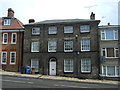
Thingoe House, in Northgate Street is now part of Cross Penny Court a retirement care home complex. Formerly it was the local council office of Thingoe Rural District Council until it ceased to exist in 1974. The plaque on the wall of the house records this occupation - see Image
North of the town centre Northgate Street and St John’s Street run towards the site of Northgate and the railway station and both streets have many older buildings. In between these two streets is a number of streets irregularly laid out (compared to the medieval grid of the town centre) containing mostly houses and buildings from the 19th century.
Bury St Edmunds is a market town which is the cultural and retail centre for West Suffolk and is known for brewing (Greene King) and sugar (British Sugar). There is scattered evidence of earlier activity but essentially Bury St Edmunds began as one of the royal boroughs of the Saxons and a monastery was founded which became the burial place of King Edmund. A new Benedictine abbey was built in 1020 which became rich and powerful and the town was laid out on a grid pattern by Abbot Baldwin. After the dissolution the abbey became ruinous. A new church, later the cathedral, was begun in the early 16th century.
Image: © Michael Dibb
Taken: 10 Sep 2020
0.02 miles
6
![Bury St Edmunds buildings [209]](https://s3.geograph.org.uk/geophotos/06/69/31/6693191_a1d10080_120x120.jpg)
Bury St Edmunds buildings [209]
This plaque on the wall of Thingoe House Image records the occupation of Thingoe Rural District Council until it ceased to exist in 1974.
North of the town centre Northgate Street and St John’s Street run towards the site of Northgate and the railway station and both streets have many older buildings. In between these two streets is a number of streets irregularly laid out (compared to the medieval grid of the town centre) containing mostly houses and buildings from the 19th century.
Bury St Edmunds is a market town which is the cultural and retail centre for West Suffolk and is known for brewing (Greene King) and sugar (British Sugar). There is scattered evidence of earlier activity but essentially Bury St Edmunds began as one of the royal boroughs of the Saxons and a monastery was founded which became the burial place of King Edmund. A new Benedictine abbey was built in 1020 which became rich and powerful and the town was laid out on a grid pattern by Abbot Baldwin. After the dissolution the abbey became ruinous. A new church, later the cathedral, was begun in the early 16th century.
Image: © Michael Dibb
Taken: 10 Sep 2020
0.02 miles
7
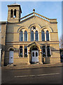
SK clinic and spa
In Victory Chapel on Northgate Street in Bury St Edmunds.
Image: © Hugh Venables
Taken: 22 Dec 2011
0.02 miles
8
![Bury St Edmunds buildings [198]](https://s2.geograph.org.uk/geophotos/06/69/08/6690858_5f9d2239_120x120.jpg)
Bury St Edmunds buildings [198]
This fine building was an Independent Chapel built in 1825. It become a Congregational Church in 1866 and was a Primitive Methodist Chapel from 1902 to 1934. Since converted and used for a variety of commercial purposes, it was, until recently, a clinic and spa beauty salon.
North of the town centre Northgate Street and St John’s Street run towards the site of Northgate and the railway station and both streets have many older buildings. In between these two streets is a number of streets irregularly laid out (compared to the medieval grid of the town centre) containing mostly houses and buildings from the 19th century.
Bury St Edmunds is a market town which is the cultural and retail centre for West Suffolk and is known for brewing (Greene King) and sugar (British Sugar). There is scattered evidence of earlier activity but essentially Bury St Edmunds began as one of the royal boroughs of the Saxons and a monastery was founded which became the burial place of King Edmund. A new Benedictine abbey was built in 1020 which became rich and powerful and the town was laid out on a grid pattern by Abbot Baldwin. After the dissolution the abbey became ruinous. A new church, later the cathedral, was begun in the early 16th century.
Image: © Michael Dibb
Taken: 8 Sep 2020
0.02 miles
9
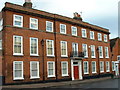
Mustow House
This is Mustow house in Mustow Street Bury St.Edmunds Suffolk.
Image: © Keith Evans
Taken: 26 Nov 2006
0.02 miles
10
![Bury St Edmunds houses [274]](https://s2.geograph.org.uk/geophotos/06/69/32/6693238_1245a49a_120x120.jpg)
Bury St Edmunds houses [274]
These two houses at 126 and 127 Northgate Street have 16th or 17th century timber framed cores refronted in white brick in the early 19th century. There is a 19th century rear extension to number 126 linked to a 16th century timber framed building that was probably originally detached. There are some original internal features remaining. Listed, grade II, with details at: https://historicengland.org.uk/listing/the-list/list-entry/1270964
North of the town centre Northgate Street and St John’s Street run towards the site of Northgate and the railway station and both streets have many older buildings. In between these two streets is a number of streets irregularly laid out (compared to the medieval grid of the town centre) containing mostly houses and buildings from the 19th century.
Bury St Edmunds is a market town which is the cultural and retail centre for West Suffolk and is known for brewing (Greene King) and sugar (British Sugar). There is scattered evidence of earlier activity but essentially Bury St Edmunds began as one of the royal boroughs of the Saxons and a monastery was founded which became the burial place of King Edmund. A new Benedictine abbey was built in 1020 which became rich and powerful and the town was laid out on a grid pattern by Abbot Baldwin. After the dissolution the abbey became ruinous. A new church, later the cathedral, was begun in the early 16th century.
Image: © Michael Dibb
Taken: 8 Sep 2020
0.02 miles