
IMAGES TAKEN NEAR TO
The Traverse, BURY ST. EDMUNDS, IP33 1BJ
Introduction
This page details the photographs taken nearby to The Traverse, IP33 1BJ by members of the Geograph project.
The Geograph project started in 2005 with the aim of publishing, organising and preserving representative images for every square kilometre of Great Britain, Ireland and the Isle of Man.

There are currently over 7.5m images from over14,400 individuals and you can help contribute to the project by visiting https://www.geograph.org.uk
Image Map
Images are licensed for reuse under creativecommons.org/licenses/by-sa/2.0
Notes
- Clicking on the map will re-center to the selected point.
- The higher the marker number, the further away the image location is from the centre of the postcode.
Image Listing (1637 Images Found)
Images are licensed for reuse under creativecommons.org/licenses/by-sa/2.0
Image
Details
Distance
1
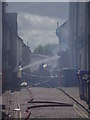
Collapsed Building
Part of the structural collapse at Cupola House Bury St.Edmunds, which is home to Strada restaurant, after the fire that started at 9pm on the 16 June 2012; this view is looking down Skinner Street at the back of the building.
For a view in its better days see http://www.geograph.org.uk/photo/1085861
For story of the fire http://www.eveningnews24.co.uk/news/update_and_picture_gallery_bury_st_edmunds_building_and_restaurant_ravaged_by_fire_1_1413030
For other views http://www.geograph.org.uk/photo/2997169 http://www.geograph.org.uk/photo/2997170
Image: © Keith Evans
Taken: 17 Jun 2012
0.00 miles
3
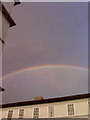
Double rainbow plus
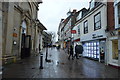
Seen over the centre of Bury St. Edmunds we see not only a double rainbow (the second outer one only just visible here) but also a set of narrow light stripes inside the main rainbow. Does anyone have an explanation for this?
Image: © John Goldsmith
Taken: 26 Oct 2011
0.01 miles
6
Fire Fighters
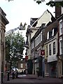
Fire fighters still working on the fire 15 hours after it started at Cupola House Bury St.Edmunds, which is home to Strada restaurant. For a view in its better days see http://www.geograph.org.uk/photo/1085861 for story of the fire http://www.eveningnews24.co.uk/news/update_and_picture_gallery_bury_st_edmunds_building_and_restaurant_ravaged_by_fire_1_1413030 For other views http://www.geograph.org.uk/photo/2997170 http://www.geograph.org.uk/photo/2997172
Image: © Keith Evans
Taken: 17 Jun 2012
0.01 miles
7
Working On The Fire
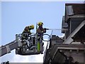
Fire fighters still working on the fire 15 hours after it started at Cupola House Bury St.Edmunds, which is home to Strada restaurant. For a view in its better days see http://www.geograph.org.uk/photo/1085861 for story of the fire http://www.eveningnews24.co.uk/news/update_and_picture_gallery_bury_st_edmunds_building_and_restaurant_ravaged_by_fire_1_1413030 for other views http://www.geograph.org.uk/photo/2997169 http://www.geograph.org.uk/photo/2997172
Image: © Keith Evans
Taken: 17 Jun 2012
0.01 miles
8
![Bury St Edmunds buildings [123]](https://s2.geograph.org.uk/geophotos/06/66/76/6667698_179f72fb_120x120.jpg)
Bury St Edmunds buildings [123]
There are three flats (number 8A) above the shop at number 8 The Traverse The building has a mid to late 16th century timber framed core refronted in white brick in the early 19th century. The rear range has much studding exposed on the Skinner Street frontage. The building housed The Three Bulls public house, later The Exchange which closed in 1903. Listed, grade II, with details at: https://historicengland.org.uk/listing/the-list/list-entry/1038272
Cornhill, Buttermarket and The Traverse are the commercial heart of the town. Cornhill incorporates the market areas set out in the 12th century where twice weekly markets are held, Buttermarket with The Traverse extend to the south connecting with Abbeygate Street and Guildhall Street. The area has some of the town’s finest and most important buildings.
Bury St Edmunds is a market town which is the cultural and retail centre for West Suffolk and is known for brewing (Greene King) and sugar (British Sugar). There is scattered evidence of earlier activity but essentially Bury St Edmunds began as one of the royal boroughs of the Saxons and a monastery was founded which became the burial place of King Edmund. A new Benedictine abbey was built in 1020 which became rich and powerful and the town was laid out on a grid pattern by Abbot Baldwin. After the dissolution the abbey became ruinous. A new church, later the cathedral, was begun in the early 16th century.
Image: © Michael Dibb
Taken: 14 Sep 2020
0.01 miles
9
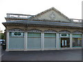
Former Jessops Shop
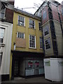
This building in The Traverse Bury St.Edmunds, Suffolk is the former Jessops shop that was forced to close after the fire next door on the 16th of June 2012 see http://www.geograph.org.uk/photo/2997169 for view of the burnt building see http://www.geograph.org.uk/photo/1085861 for a distant view of Jessops and the unburnt building. Jessops opened a new shop in The Arc shopping centre late 2012 see http://www.geograph.org.uk/photo/3293842
Image: © Keith Evans
Taken: 13 Jan 2013
0.01 miles
10
![Bury St Edmunds buildings [122]](https://s3.geograph.org.uk/geophotos/06/66/76/6667679_93b6d721_120x120.jpg)
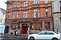
Bury St Edmunds buildings [122]
This fine town house was originally two timber framed 17th century buildings before being converted into one house with a large shop on the ground floor. It was extensively altered circa 1679 with Baroque-style features, including a wrought-iron balcony and the cupola. At one time, a public house known as The Victoria, it became a bar and restaurant in 2002. A fire in 2012 seriously damaged the building. Restored, it reopened as a restaurant in 2017. Listed, grade II, with much detail and history at: https://historicengland.org.uk/listing/the-list/list-entry/1038264
Cornhill, Buttermarket and The Traverse are the commercial heart of the town. Cornhill incorporates the market areas set out in the 12th century where twice weekly markets are held, Buttermarket with The Traverse extend to the south connecting with Abbeygate Street and Guildhall Street. The area has some of the town’s finest and most important buildings.
Bury St Edmunds is a market town which is the cultural and retail centre for West Suffolk and is known for brewing (Greene King) and sugar (British Sugar). There is scattered evidence of earlier activity but essentially Bury St Edmunds began as one of the royal boroughs of the Saxons and a monastery was founded which became the burial place of King Edmund. A new Benedictine abbey was built in 1020 which became rich and powerful and the town was laid out on a grid pattern by Abbot Baldwin. After the dissolution the abbey became ruinous. A new church, later the cathedral, was begun in the early 16th century.
Image: © Michael Dibb
Taken: 14 Sep 2020
0.01 miles